Snow could arrive for most of us by the end of the month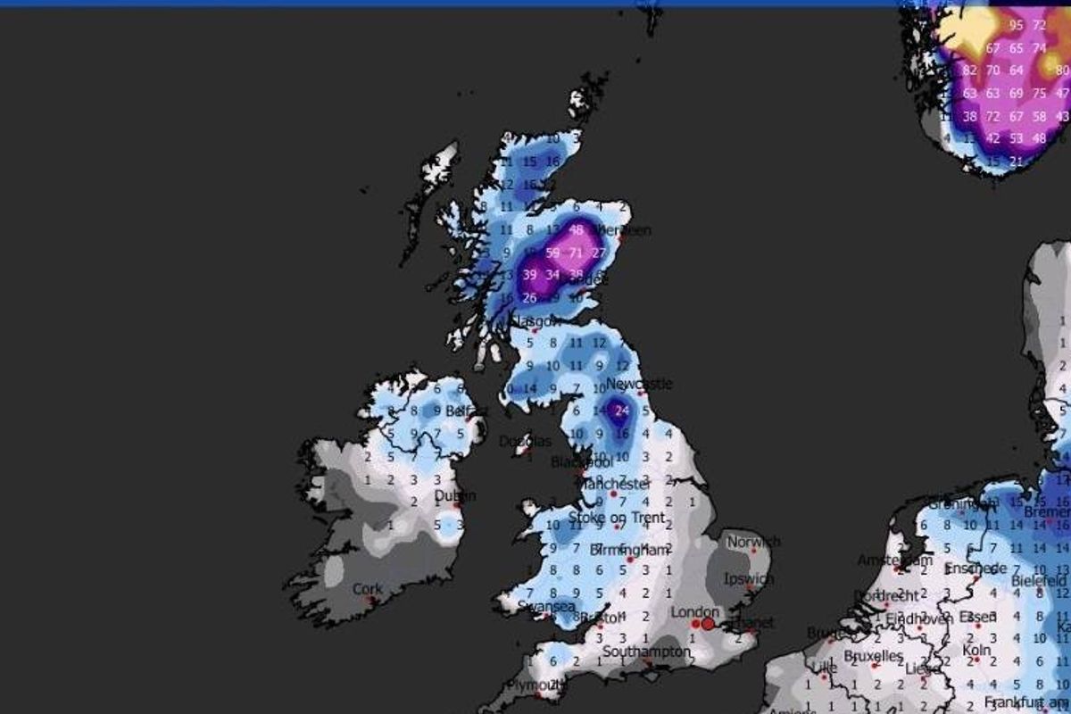
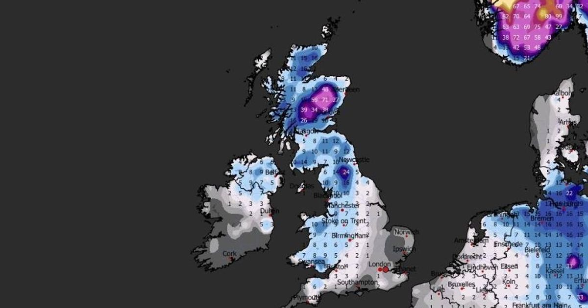
A map showing snow due to fall across the country on January 31 at midday(Image: WXCharts)
Weather maps appear to show snow falling in the UK as the Met Office forecasts a heightened likelihood of chilly conditions.
It’s been a somewhat milder week for many regions after a frosty start to 2026, but predictions suggest that people should keep their winter gear handy with more wintry weather expected throughout January.
Maps allegedly show over 70cm of snow falling in certain parts of the country.
Maps appear to depict low pressure systems approaching from the north and west, bringing unsettled conditions and snow where the moisture encounters the cold air moving southwards from the Arctic.
For the final week of January, heavy snow is anticipated due to a low pressure system affecting the weather as it traverses the country from the Atlantic, bringing two blizzards in waves.
A map from WXCharts for 31st January shows snow falling from the north of Scotland down to the south coast. The heaviest flurries are in central Scotland where at 6pm it indicates a depth of 71cm, while in northern England there is 24cm falling, reports the Mirror.
In the last week of January, the maps predict heavy snow in the north of the UK before it spreads to the south.
It’s expected to be bitterly cold with temperatures plummeting to -14C in central Scotland on 30th January and barely above freezing anywhere in the country.
The Met Office states that there is an “increased chance” of temperatures dropping further after the mercury initially falls in the North East.
The forecast for the period January 22-31 reads: “Throughout this period, the UK will see a battle between Atlantic weather systems attempting to arrive from the west while high pressure and colder conditions attempt to exert some influence from the east. Initially, milder Atlantic air is expected to dominate for the majority of the country.
“This should maintain often cloudy, changeable conditions with showers or longer spells of rain for most, with the wettest weather in western parts of the country. Temperatures overall likely to be around average, though likely quickly becoming colder in the north east, after which there is an increased chance that conditions will turn more generally colder.
“This aspect of the forecast is still somewhat uncertain but the potential transition to colder weather also increases the chance of snow across parts of the country.”