
While the thunderstorm risk will shift south, there is a large amount of uncertainty still.
RELATED: Storm downs trees, knocks out power in Mattawa, Ont., area
Lake breezes may trigger severe storms along the Lake Erie shores, tracking into the Niagara Peninsula. It is uncertain if the relatively weaker storm trigger can override the suppressing heat. If it does, we may have a boom setup for funnel clouds or a landspout tornado.
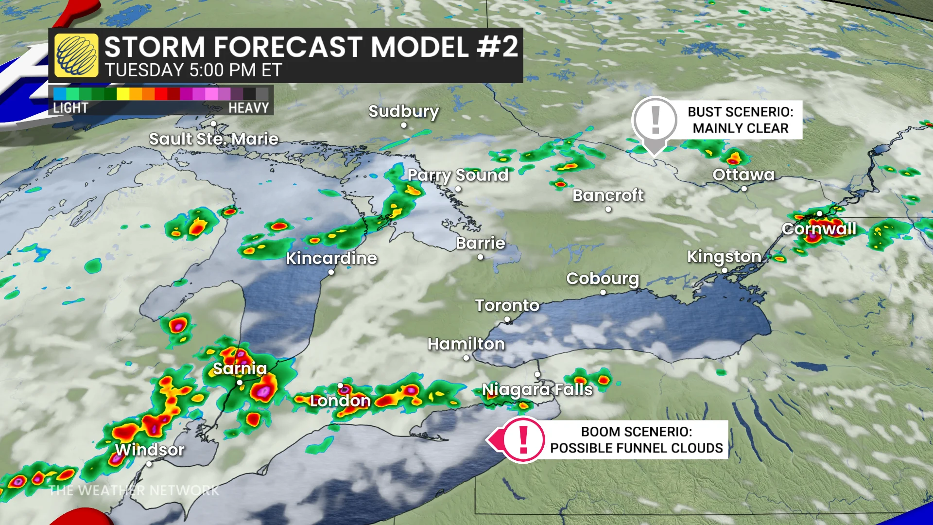
Storms elsewhere in southern Ontario, including the Greater Toronto Area (GTA), have the chance to produce downpours. Amounts of 40-80 mm are possible, so localized flooding on roadways is on the table.
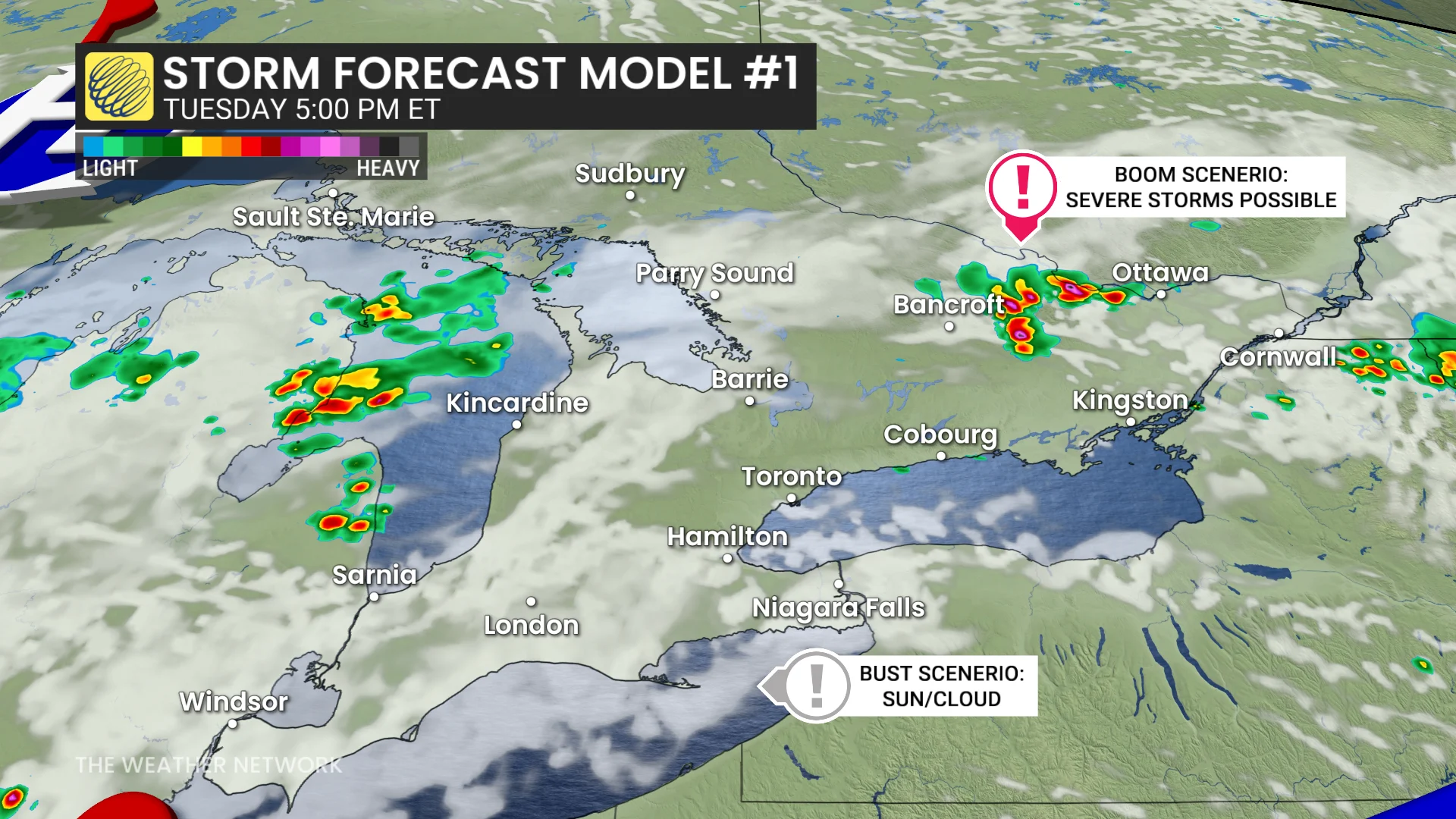
If the lake breezes fail, eyes will be on the Ottawa region for the ring-of-fire thunderstorm cluster moving through by the late-afternoon period.
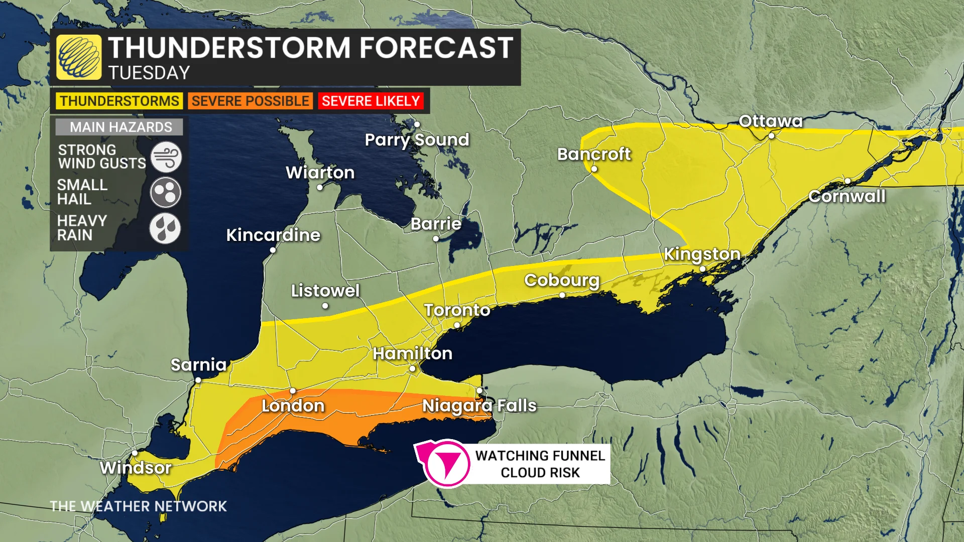
The risk also continues for eastern Ontario and southern Quebec, with some stronger storms possible by the late afternoon, too, including Ottawa, Gatineau and Montreal.
Stay with The Weather Network for more information and updates on your weather across Ontario and Quebec.