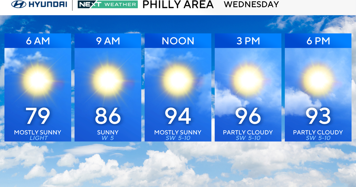
Tuesday brought record-setting heat around parts of the Philadelphia area, and PHL recorded a 98-degree high temp, tying the record set in 2002, and we will likely do it again on Wednesday!
But what will it feel like? Along with the increasing temperatures, the humidity will also be on the rise, making it feel like anywhere between 100-105 degrees, perhaps even hotter in spots at times.

CBS News Philadelphia
When temperatures climb this high, it can be dangerous for anyone without adequate ways to stay cool and hydrated. As a result, the NEXT Weather Team has issued a NEXT Weather Alert through Wednesday evening.
A few storms may fire up late Wednesday, but there is a much greater chance of storms by Thursday. Those showers and storms will develop ahead of an approaching cold front that will put an end to this heat wave and usher in much cooler air by Friday.
In fact, high temps Friday will likely only top out in the mid-low 70s, much closer to the record coldest high temp (69 degrees) than the normal high in the upper 80s.
Friday is also the start of August, and the start of an extended cooler stretch of air bringing relief from the heat through the first week of August.
Highs Friday and into the weekend will be in the upper 70s to low 80s, with morning low temps in the mid-low 60s. In fact, many places Sunday morning will likely be in the 50s!
Here’s your 7-day forecast:

CBS News Philadelphia
Wednesday: NEXT Weather Alert for heat. High 98, Low 78.
Thursday: P.M. storms. High 87, Low 76.
Friday: Shower early. High 75, Low 68.
Saturday: Beautiful. High 82, Low 64.
Sunday: Sunny, nice. High 83, Low 62.
Monday: Mostly sunny. High 84, Low 63.
Tuesday: Mostly sunny. High 85, Low 65.
More from CBS News