PHILADELPHIA – Big changes are on the way for the Delaware Valley as the extreme heat gives way to potential severe weather and much cooler temps by the end of the week.
What we know:
Wednesday fell one degree short of the record high, while everywhere else across the region was sweltering in the heat.
Overnight won’t cool off much and Thursday will see highs reach the upper 80s.
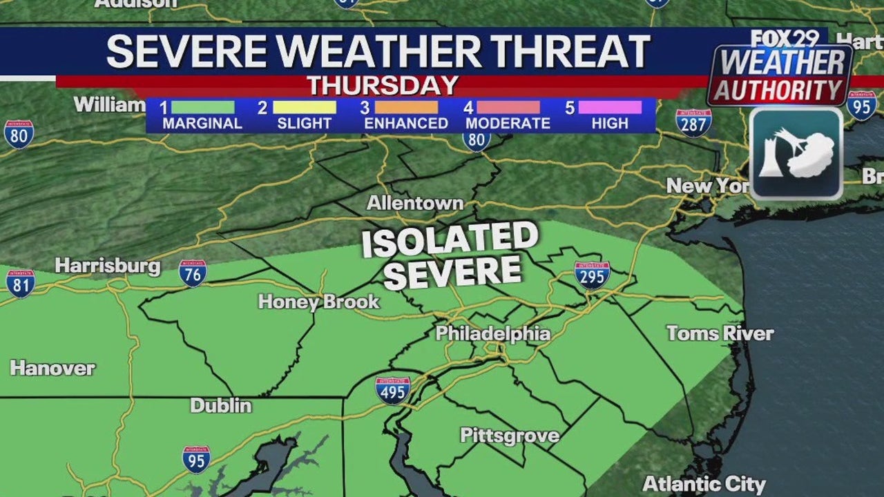
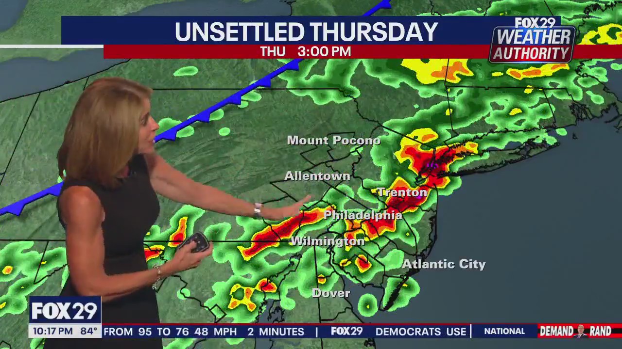
Stopping the heat will be a front that will bring potential severe weather and certainly heavy rainfall in the mid to late afternoon hours.
The National Weather Service has issued a region-wind flood watch from Thursday afternoon until early Friday morning. There is the possibility of wind damage with this system, but the rainfall amounts are likely to be high, hence the watch.
Forecasters say there is a potential of rainfall rates exceeding two inches per hour for portions of the area.
Areas prone to flooding should be avoided in the evening rush hour wherever possible.
What’s next:
Friday will see lingering showers in the morning and cloudy conditions with afternoon highs just barely reaching the mid-70s. What a turn of events!
The weekend will be beautiful, with mostly sunny skies and highs in the 80s. The first full week of August looks just as pleasant.
What you can do:
Stay up-to-date on the incoming storms and the holiday weekend forecast by downloading the free FOX LOCAL app.