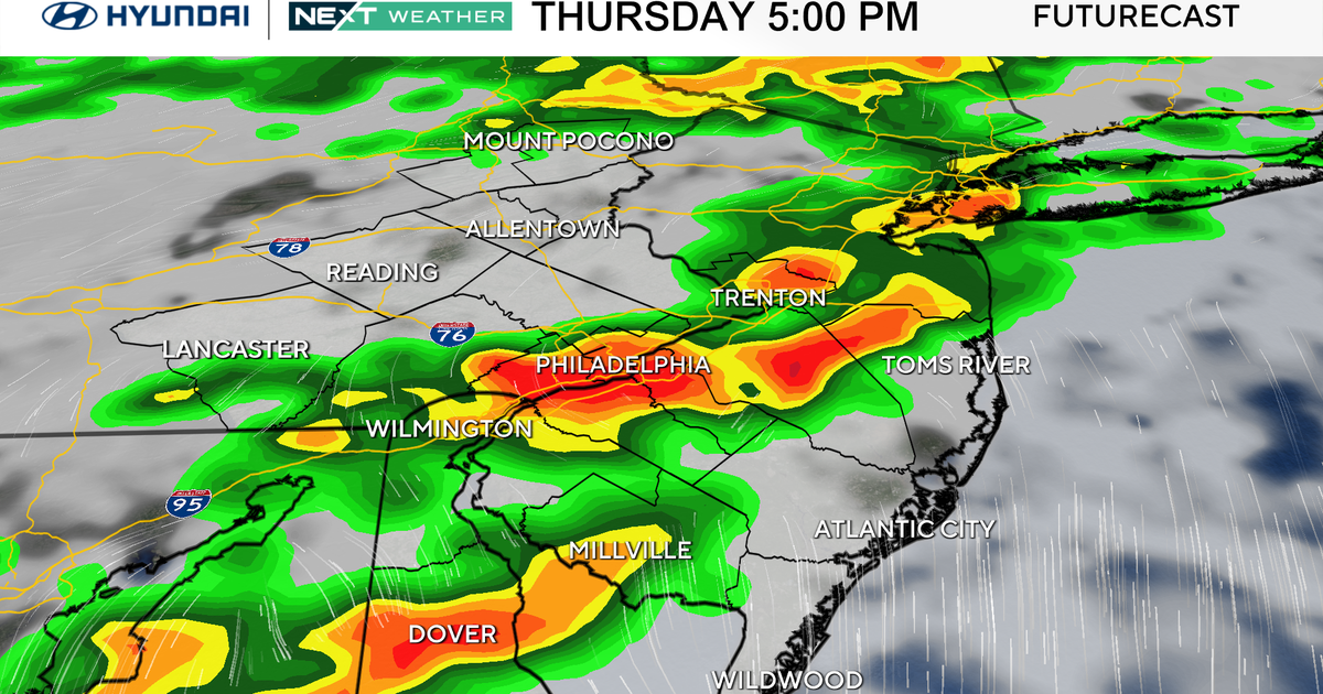
Thursday will bring the fourth day in a row with a NEXT Weather Alert, though it will be due to storms and flooding, not necessarily the heat. It will be hot, but it won’t be as hot as the previous days.
Those showers and storms will develop ahead of an approaching cold front that will put an end to this heat wave and usher in much cooler air by Friday. They will also be bringing flooding rain and the chance for a severe storm or two, mainly in the form of damaging winds.
The Storm Prediction Center has our area in a moderate risk for flooding, which is a 3 out of 4 on the risk scale. The primary time frame for the greatest impacts will be 2 p.m. to 9 p.m., with a heavy focus near the evening commute.

CBS News Philadelphia
On Friday, the high temps will likely only top out in the mid-low 70s, which is much closer to the record for the coldest high temp (69 degrees) than the normal high in the upper 80s.
Friday is also the start of August and the start of an extended cooler stretch of air bringing relief from the heat through the first week of the month.
Highs Friday and into the weekend will be in the upper 70s to low 80s, with morning low temps in the mid-low 60s. In fact, many places Sunday morning will likely be in the 50s.

CBS News Philadelphia
Here’s your 7-day forecast:

CBS News Philadelphia
Thursday: NEXT Weather Alert for heavy rain. High 90, Low 76.
Friday: Shower early. High 73, Low 67.
Saturday: Beautiful. High 82, Low 64.
Sunday: Sunny, nice. High 84, Low 62.
Monday: Mostly sunny. High 85, Low 62.
Tuesday: Mostly sunny. High 82, Low 64.
Wednesday Showers possible. High 98, Low 78.
More from CBS News