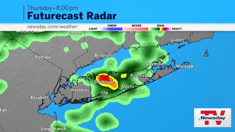
The National Weather Service has issued a flood watch for Long Island and the entire New York City region as a slow-moving storm system could bring heavy rain and high winds Thursday afternoon.
The flood watch is in effect from 2 p.m. Thursday through Friday morning, the result of a frontal system of rain and thunderstorms expected to bring the potential for scattered to numerous instances of flash flooding. Thursday afternoon into the evening. The steady rainfall could make the evening commute difficult, forecasters said.
Localized severe flooding is possible in this area, the weather service said. Rainfall totals for NYC and western Long Island could reach between 1½ and 3 inches, with 2 inches per hour possible, the weather service said. Eastern Long Island could get less, but still heavy rain in places.
Much of the rain could fall within 3 to 6 hours Thursday afternoon into the evening, the weather service said.
A widespread area of light to moderate rain could linger across the area overnight Thursday, which could prolong any ongoing flooding.
Thursday’s rains follow a humid morning with highs in the mid-80s. The looming storms will bring northeast winds of 13 to 17 mph, with gusts near 30 mph, and deep drops in temperatures.
The heavy rain will usher in a weekend of moderate daytime temperatures and low humidity, a distinct departure from the three days of high heat and humidity that have covered Long Island and the region since Monday.
After morning rain, Friday will be mostly cloudy with a high near 74 and gusty winds, forecasters said.
Saturday is forecast to be sunny, with a high near 81, with northeast winds of 7 to 9 mph.
Sunday is also expected to be sunny, with a high near 84.
Check back for updates on this developing story.