HOUSTON – Rain chances will be increasing heading into Friday and the weekend.
Highs in the upper 90s with a few storms
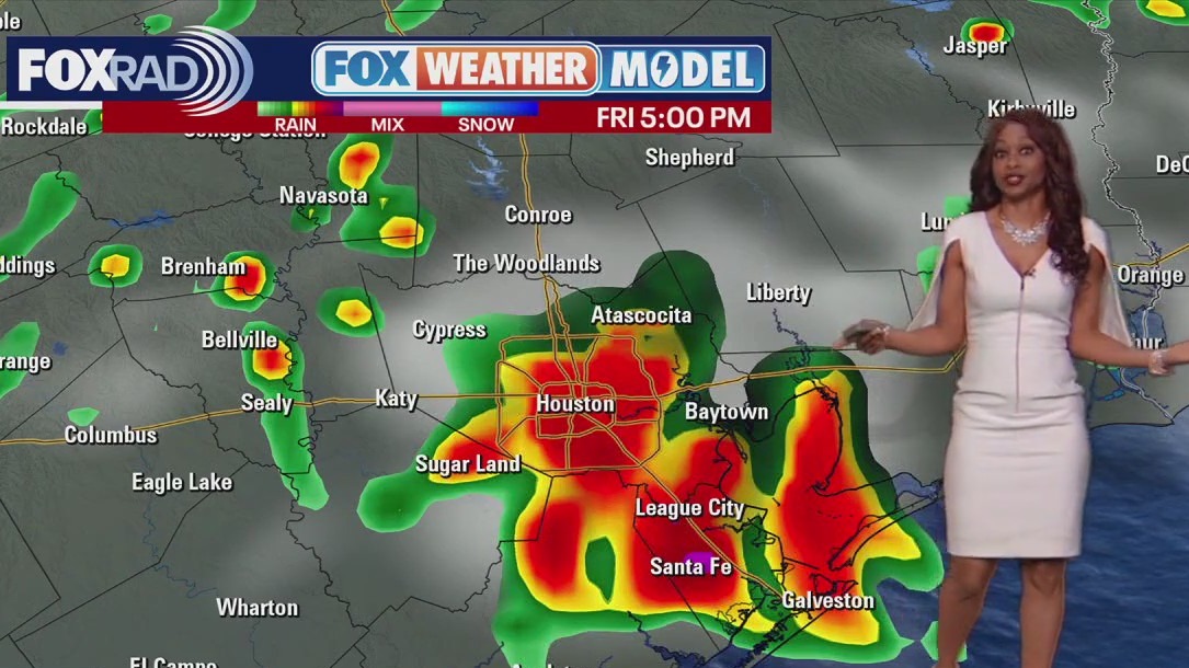
After hitting highs that ranged from 96 to 101 on Wednesday and today, we’ll head for the mid and upper 90s again, but with the addition of pop-up afternoon storms.
Due to the heat island that forms over the city, sometimes these storms can form inside the Beltway and might hang around through the afternoon rush.
It’s also possible that they affect other areas as some of our newer model runs have been turning more aggressive with rain today.
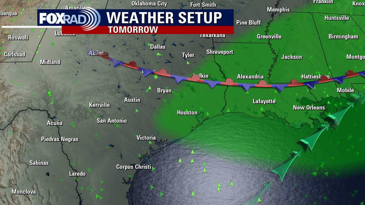
Increasing rain late this week
Friday will also bring a decent chance for scattered afternoon storms, then we have a tricky weekend forecast.
A cold front will approach, then stall, and it’s a challenge as to how close to Houston the front will stall.
For now, count on muggy air and a good chance for showers and a few storms this weekend.
7-Day Forecast 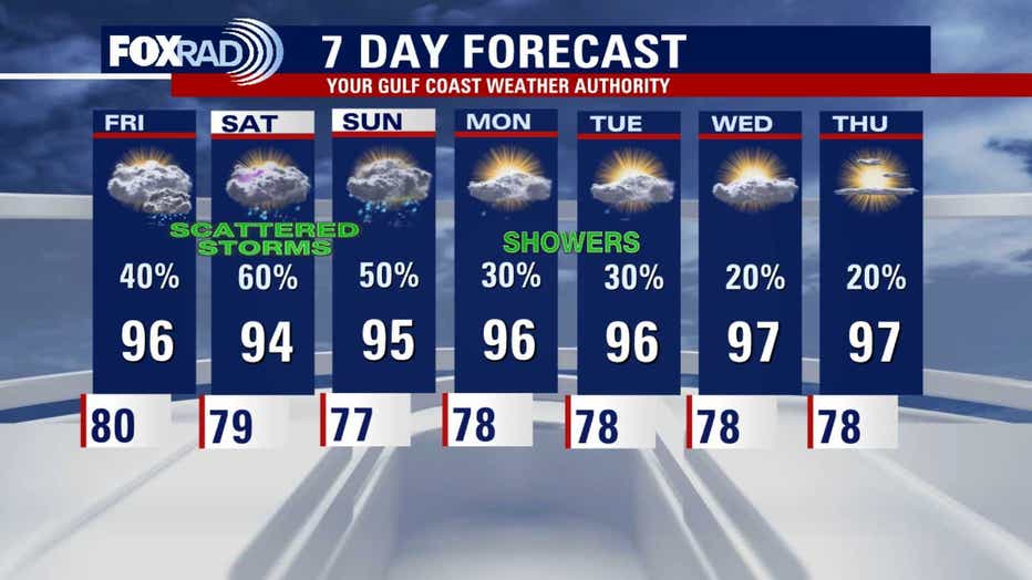 No tropical systems with plenty of dust
 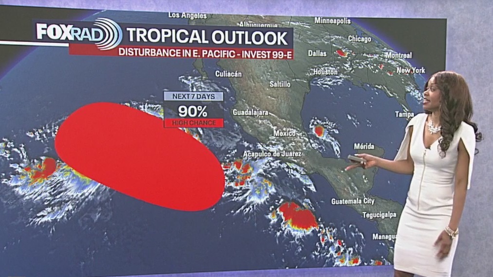 Tropical Weather Forecast – Atlantic basin remains quiet, but don’t let down your guard!
So far this hurricane season, Saharan dust has dominated across the Atlantic resulting in a lack of many strong tropical waves and a quiet pattern. In the short-term, no storms are expected, but as we head into August and especially mid-August, expect a more active tropical pattern for the Caribbean, Gulf and Atlantic. September is typically the busiest month of the Atlantic basin hurricane season.
So far this hurricane season, Saharan dust has dominated across the Atlantic, resulting in a lack of many strong tropical waves and a quiet pattern.
In the short-term, no storms are expected, but as we head into August and especially mid-August, expect a more active tropical pattern.
The Source: Information above from Your Gulf Coast Weather Authority.