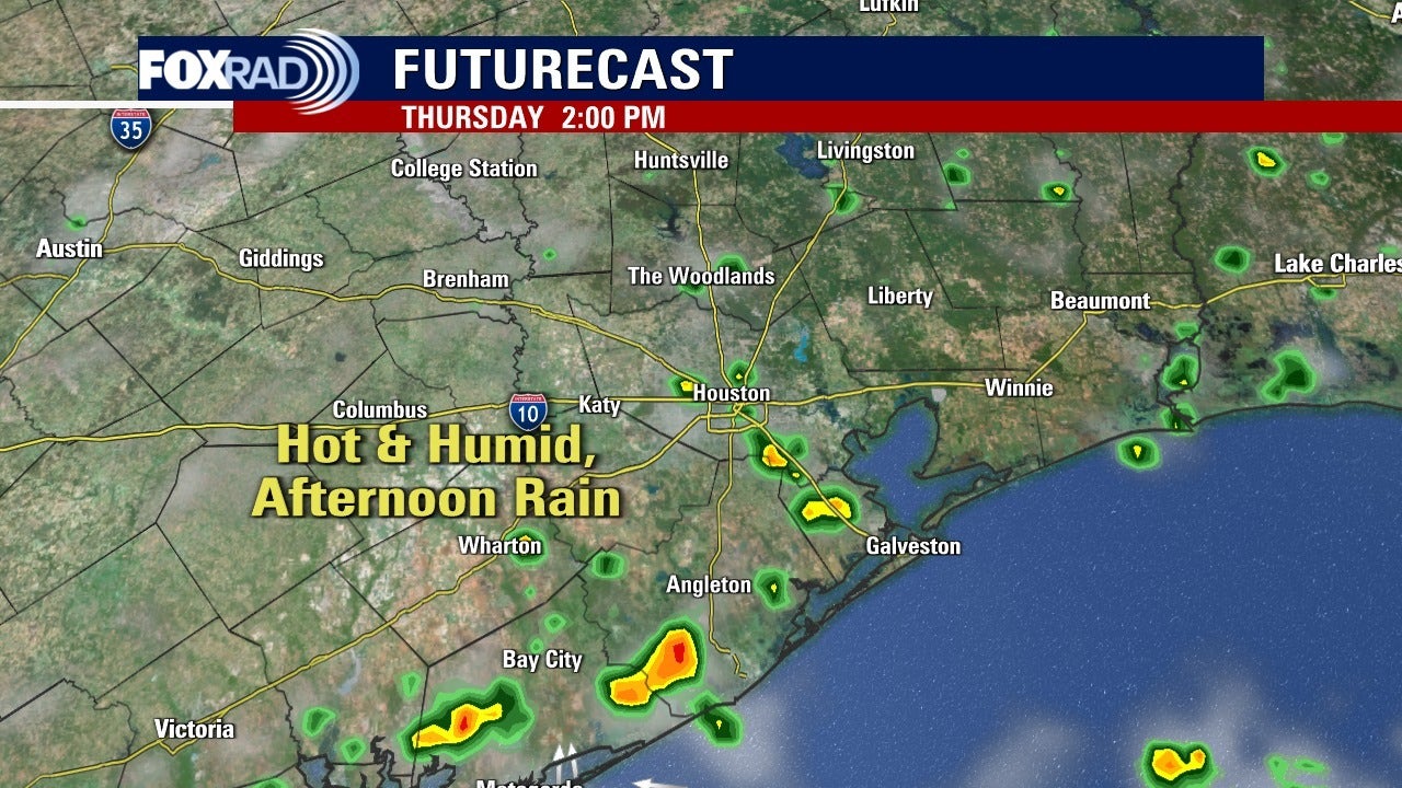
HOUSTON – Morning showers and storms will be possible for Thursday morning.
Houston weather: Showers, storms possible for Thursday “RINSE AND REPEAT” SUMMER PATTERN
Gulf breezes, partly cloudy skies and spotty storms will hold our temperatures close to average. Expect highs in the mid 90s, some upper 90s inland and low 90s near the beaches. Each day will bring a few morning showers near the coast and scattered inland storms each afternoon. There aren’t many major changes each of the next several days, so weather in your area will be mostly subject to the randomness of where storms set up each day.
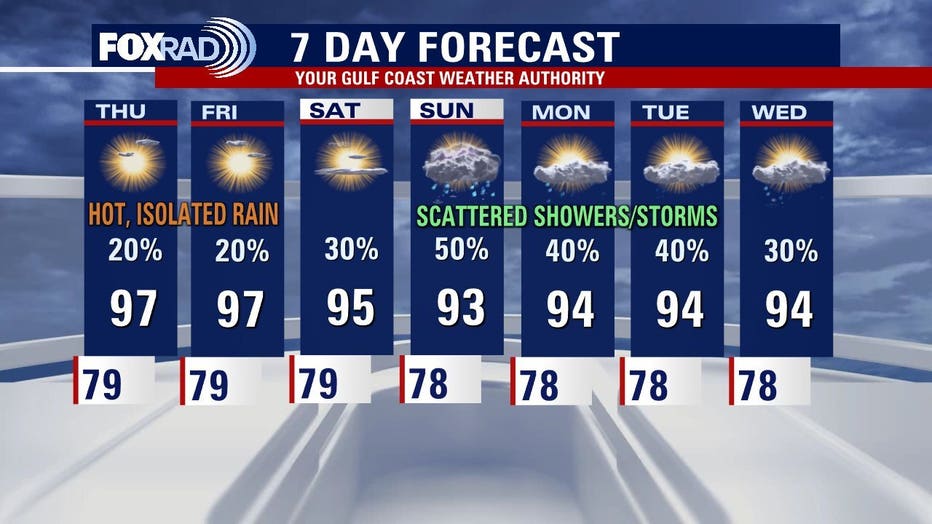
 LONG-TERM FORECAST LOOKS HOT
Expect a few more showers at the end of this week and beginning of next week. The outlook for most of next week hints at highs in the upper 90s with more spotty afternoon downpours.
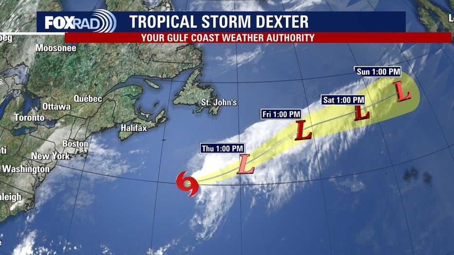
 A FEW AREAS TO WATCH IN THE ATLANTIC
Tropical Storm Dexter is still moving deeper into the central Atlantic Ocean. It’s still moving away from land and will become extratropical over the next day or two. Elsewhere, a low could develop east of Florida and south of the Carolinas that could bring them late-week rain. Models are showing it getting organized, then moving away from the US. We’ll also monitor two more tropical waves: one has about a 60% chance of becoming a depression of storm, but is very far away from Texas. A stronger wave could move into the eastern Atlantic by late this week and the GFS model is showing it eventually becoming a hurricane late next week, but all that is uncertain at this point. It’s not impossible that a storm could approach the Caribbean and/or the Gulf by mid to late August, so we’ll keep you updated.
The Source: Information from Your Gulf Coast Weather Authority Team.