 Mag
MagDepthDistanceLocationDetailsMap
4.2
5 km
4.0
63 km
4.0
15 km
4.0
10.9 km
4.5
61 km
5.8
17 km
6.2
10 km
6.2
10 km
8.0
60 km
6.0
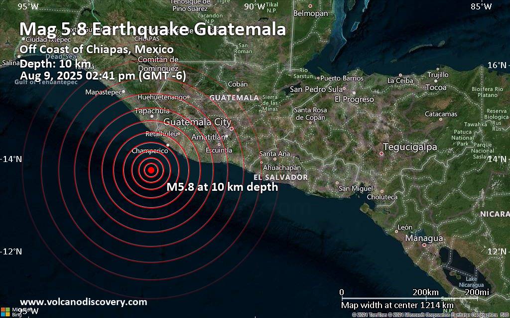
10 km
6.4
66 km
6.5
20 km
7.4
24 km
5.9
18 km
6.0
14 km
6.7
24 km
5.9
36 km
6.1
39 km
7.2
34 km
6.0
63 km
6.8
27 km
5.9
36 km
7.0
67 km
6.5
65 km
6.1
39 km
6.0
28 km
7.3
35 km
6.5
35 km
6.5
25 km
6.8
25 km
6.2
65 km
7.1
65 km
7.0
25 km
7.7
35 km
6.8
35 km
6.8
45 km
6.1
15 km
6.4
15 km
7.3
35 km
7.1
15 km
6.9
35 km
7.8
0 km
7.5
0 km