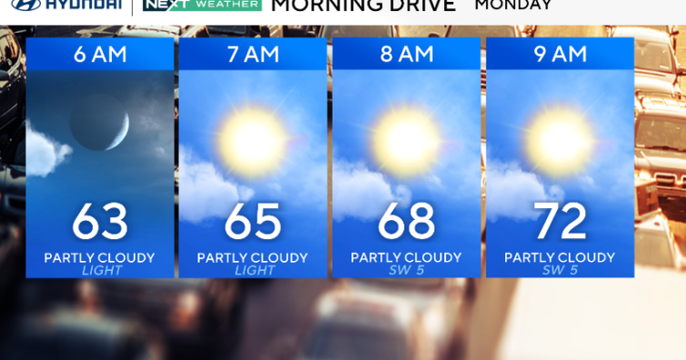
Monday in the Philadelphia region will be a touch warmer, with any early fog burning off quickly, leaving us with plenty of sun and highs in the mid to upper 80s. A few spots along the I-95 corridor will hit 90 degrees.
That warm-up keeps going Monday night into Tuesday as hotter air moves in ahead of a cold front. Tuesday will be hot but not extreme — upper 80s to low 90s for most, cooler near the coast. Humidity will be noticeable, but heat index values should stay just shy of advisory levels. Wednesday looks about the same, and we could see a couple of pop-up storms in the afternoon but most areas will stay dry.

Monday in the Philadelphia region will be a touch warmer with plenty of sun and highs in the mid to upper 80s.
CBS News Philadelphia
By Thursday, a weak cold front slips in, bringing just a slight chance for a shower or storm. Highs will be near 90 degrees again, with sticky dew points early in the day before they start to drop from northwest to southeast.
Friday into the weekend, that front may stall or fall apart. We could get a touch less humidity, but it’ll still feel summery with highs in the 80s. Rain chances stay low, and there’s no sign of any extreme heat.
In the tropics, we are watching a wave off the coast of Africa that has a 70% chance of developing into a named storm in the next seven days. Forecast models are trending toward a westerly track toward the Caribbean and Gulf. It is too early to say if this will affect the United States later in the month, but it is definitely worth watching. If it does reach tropical status, the storm name will be “Erin.”
Here’s your 7-day forecast:

CBS News Philadelphia
Monday: Sunny. High 89, Low 63.
Tuesday: Plenty of sun. High 91, Low 68.
Wednesday: Scattered storms. High 89, Low 73.
Thursday: Isolated shower. High 91, Low 73.
Friday: Partly cloudy. High 92, Low 72.
Saturday: Sunny skies. High 90, Low 70.
Sunday: Sunny skies. High 92, Low 71.
More from CBS News