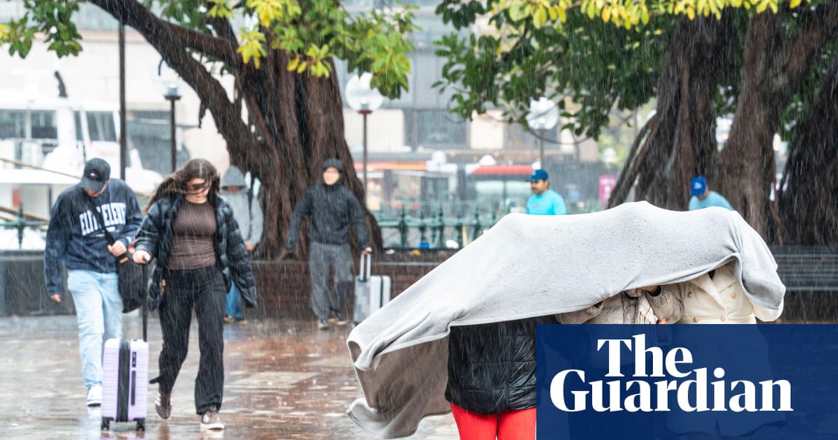
After Sydney’s soggiest start to August in nearly three decades, even more rain could be on the way with a wetter than usual spring forecast for eastern New South Wales.
Only 11 days into August, rainfall in the city had reached 194mm – more than double the monthly average – marking the wettest start to the month since 1998, according to Weatherzone.
Moist onshore winds had delivered a weekend washout, and so much rain the Byron Writers festival had to be called off, as 90,0000 runners in Sydney’s City2Surf persevered in spite of the slippery conditions.
Along or near much of the NSW coastline – from the Illawarra to Sydney, the Hunter, mid north coast and some parts of the north coast – totals had already hit or exceeded the monthly average, said Jonathan How, a senior meteorologist at the Bureau of Meteorology.
Abnormally high sea surface temperatures off the state’s coast had contributed to the wet conditions, he said, boosting the moisture content of clouds, as a persistent high pressure system over New Zealand kept pushing rain and moisture on to the coast.
The wet start to August followed a wetter than usual July, in which several places recorded their highest July rain on record.
And eight months into 2025, Sydney was already tracking wetter than average, said How. That came off the back of three out of four years with rainfall well above average, including 2022 – the city’s wettest on record.
Sign up: AU Breaking News email
The NSW east coast was generally “quite a wet place”, said University of Melbourne associate professor Andrew King, but for many residents – particularly from the mid north coast upwards – this year had been rainier than usual.
“We have seen some really major rain events this year,” he said. Several places recorded their wettest May on record, when a low pressure trough developed off the coast of NSW on 18 May and lingered for days.
The crowd brave the rain during the NRL Round 22 match between the Manly Warringah Sea Eagles and the Sydney Roosters at Brookvale Oval in Sydney, Saturday, 2 August, 2025. Photograph: Steven Markham/AAP
King said the NSW coastline was subject to various types of systems that created the conditions for rising air, condensation and rain – thunderstorms, fronts from the west, winds from the east bringing coastal showers, and east coast lows – all of which could bring heavy rainfall to the eastern coast of NSW, including Sydney.
In an average year, Sydney received more than a metre (1,044mm) of rain, roughly double the amount that falls in Melbourne (518mm), Adelaide (547mm) and Hobart (569mm), according to Bureau of Meteorology climate data for 1981-2010. Sydney was the third wettest capital city, after Darwin and Brisbane.
But that wasn’t the whole picture, How said. August had been a completely different story inland. It was very wet in the east, but also very, very dry in the west, with many places receiving “next to no rainfall so far this month”.
The Bureau’s long range forecast for September to November anticipated above-average rainfall would continue for the eastern two-thirds of Australia, with an increased chance of unusually high rainfall (in the highest 20% of records between 1981 and 2018) for parts of eastern Queensland, NSW, south-east SA and northern Victoria.
With northern Australia expected to get wetter, and the south-west of the country drier due to global heating, the projections for rainfall in NSW weren’t as clearcut, King said.
At least in the short term – for the week ahead – Sydneysiders could at least look forward to one or two fine days. “The good news is that the heaviest of the rain is now behind us,” How said, with drier days returning and Friday likely to be the “pick of the week”.