Weather in the Philadelphia area is once again foggy on Thursday before more storms arrive in the afternoon hours.
The morning fog will likely become more widespread around daybreak, but we’re already seeing low visibility around the Brandywine Valley in Pennsylvania and Delaware.

CBS News Philadelphia
As far as the storms, these will likely blossom by midday along the I-95 corridor before moving east. We are under a low, Level 1 risk of flooding today, as these storms could be slow-moving and produce flooding downpours.
Expect storms to move out by 8 p.m. before we dry out for Friday.

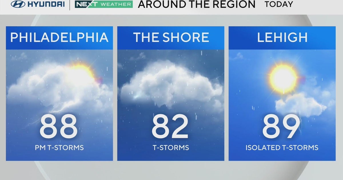
Otherwise, expect high temperatures in the 80s across the region, a little cooler at the Shore. Up in the Lehigh Valley, which got more of the brunt of the storms on Wednesday. Storms should be more isolated on Thursday.
Out in the Atlantic Ocean, Tropical Storm Erin is expected to begin really strengthening today. We will keep an eye on the storm that could become the first major hurricane of the 2025 season.
Humidity will remain in the “muggy” to “gross” range on our muggy meter through the weekend, but there should be sunshine Saturday for the Eagles’ preseason game versus the Cleveland Browns at Lincoln Financial Field.

CBS News Philadelphia
Here’s your 7-day forecast:

CBS News Philadelphia
Thursday: Humid with a PM T-Storm possible. High 88
Friday: Sun, chance of a PM shower. High 89, Low 74
Saturday: Mostly sunny. High 88, Low 71
Sunday: Mostly sunny. High 91, Low 71
Monday: Some sun, T-Storm chance. High 88, Low 73
Tuesday: Mostly sunny. High 81, Low 67
Wednesday: Partly cloudy. High 82, Low 68
More from CBS News