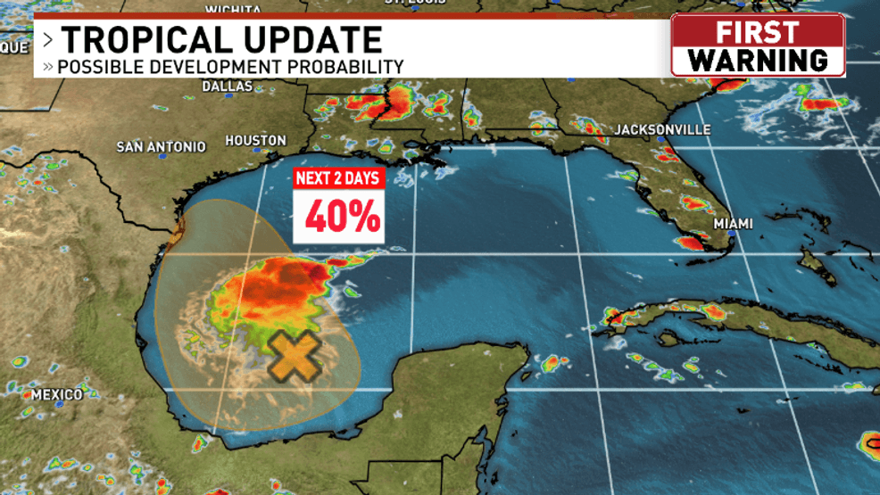
SAN ANTONIO – Tropical wave Invest 98-L is making steady progress through the southwestern Gulf and has its eyes set on South Texas. The system has a 40% chance from the National Hurricane Center (NHC) to become a Tropical Depression before reaching the Texas coast late Friday. Regardless of if it becomes a Tropical Depression or not, it will bring San Antonio and increased rain chance for the first half of the coming weekend.
By Friday morning, the system will be offshore of Brownsville with a center of circulation trying to develop before the system reaches land.
An increase in tropical moisture will occur along the Texas coast throughout the day Friday, leading to scattered showers and storms by the afternoon. An isolated rain chance will exist further inland towards San Antonio, but the overall coverage of activity will be low Friday evening.
The highest coverage of rain near the San Antonio area will occur Saturday morning as the system pushes inland, bringing with it pockets of tropical rain with potentially high rainfall rates.
The activity will turn more isolated later in the day Saturday, and Sunday will be just hot and dry. Total rainfall through Saturday evening will be light for areas out west, with the potential for 1-3+” somewhere near the I-35 & I-37 corridors. This could lead to some pockets of isolated flash flooding. Many other areas see only light rainfall amounts, so it will all depend on where the tropical downpours set up. All in all, expect a potentially soggy start to the weekend with activity wrapping up by Sunday.