Buffalo, N.Y. (WBEN) – The warm and dry conditions responsible for placing a portion of the Buffalo-Niagara region under ‘moderate’ drought conditions, will soon be replaced by a change in pattern that will bring cooler and wetter conditions.
But not before more heat for the first half of the mid-August weekend.
Warmer & drier than normal weather has dominated much of western & north central NY since the start of July. The pattern is expected to take more of a trend toward cooler and wetter than normal over the next few weeks. Latest drought conditions & extended outlooks attached below. pic.twitter.com/8p0fm9y6IS
— NWS Buffalo (@NWSBUFFALO) August 16, 2025
The National Weather Service in Buffalo shows portions of northern Erie County and southeast Niagara County as suffering from ‘moderate’ drought, while the remainder of Western New York is characterized as ‘abnormally’ dry.
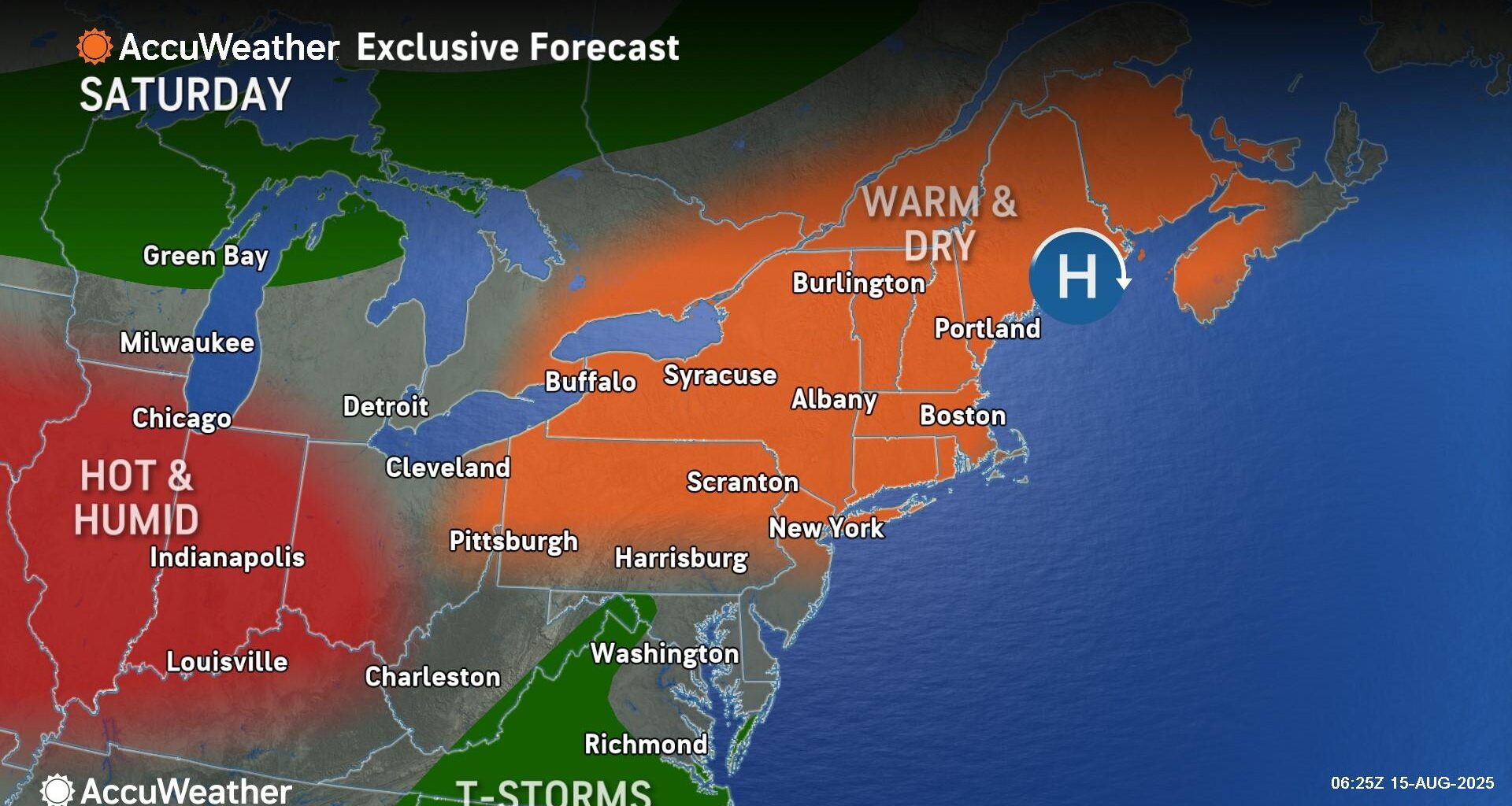
We’ll need to withstand at least one more full day of dry heat, before a pattern shift brings relief Sunday, forecasters say. Saturday’s high temperatures are forecast in the upper 80’s to low 90’s.
A cold front will bring the chance for some showers on Sunday, followed by cooler weather for the start of the work week.
Scattered showers may begin during the overnight hours into Sunday morning, with some thunderstorms and additional showers likely midday Sunday as the front passes through the region.
High pressure will provide mostly dry conditions late Sunday afternoon through Monday evening.
Temperatures on Sunday will reach the low to mid 80’s from north to south with the passing cold front. Temperatures will continue to cool into Monday with below normal highs expected and afternoon temperatures reaching from near 70 to near 80 from the higher to lower elevations respectively.
Cooler temps with highs in the 70’s are forecast through midweek, with day to day warming for the remainder of the work week.
Featured Image Photo Credit: AccuWeather.com