Yahoo is using AI to generate takeaways from this article. This means the info may not always match what’s in the article. Reporting mistakes helps us improve the experience.Generate Key Takeaways
The Brief
-
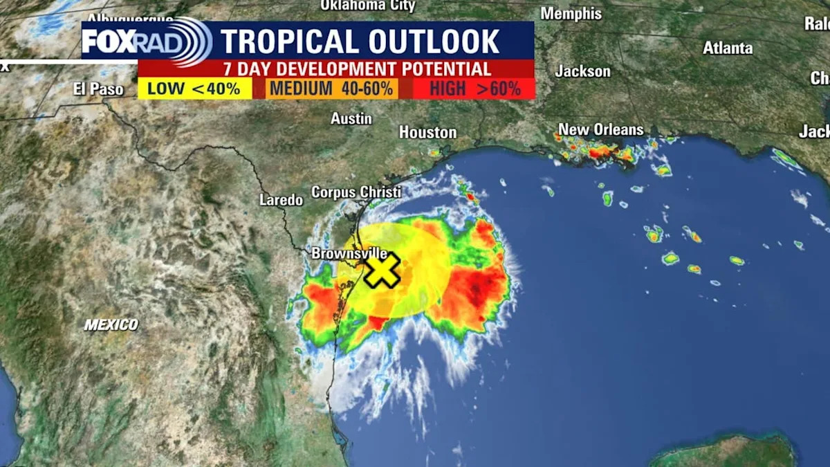
The chances of development for a tropical wave in the Gulf has decreased to near-zero.
-
The center of the disturbance is moving across land, bringing heavy rain to parts of Mexico and South Texas.
-
It is helping to increase rain chances in the Houston area.
HOUSTON – The center of a tropical disturbance that flared up in the Gulf began to move across land on Friday, bringing heavy rainfall to parts of northeastern Mexico and South Texas.
It is helping to increase rain chances in the Houston area, and some storms are possible through Saturday.
Tropical development brings rain to Mexico, Texas
By the numbers
On Friday morning, the National Hurricane Center was giving the area of low pressure in the Gulf a medium 50% chance of development over the next 48 hours. However, around midday, the NHC dropped the chances to near-zero as the center began to move inland near the Rio Grande.
Timeline
The disturbance is not expected to develop any further as it moves across land. However, the National Hurricane Center says lingering showers and thunderstorms could still bring heavy rain to parts of northeastern Mexico and South Texas through the day.
Will Houston be impacted?
Local perspective
For us in Southeast Texas, heavy rain, isolated street flooding and a high rip current risk are likely on both Friday and Saturday.
We are in a 1/4 risk for flooding. Stay weather aware for any changes.
Hurricane Erin forms in the Atlantic
Dig deeper
Elsewhere, Erin has strengthened to a hurricane and could become a major hurricane this weekend or sooner. It will stay north of the Caribbean and mainly pose a risk to Bermuda while bringing larger waves to the beaches from Florida to New England.
The Source
The information in this article comes from the National Hurricane Center and the FOX 26 weather team.