PHOENIX (AZFamily) — Highs will continue to be near-normal into Sunday and then start to rise into 110+ territory by the middle of next week. The chance of storms will increase by the end of next week into next weekend.
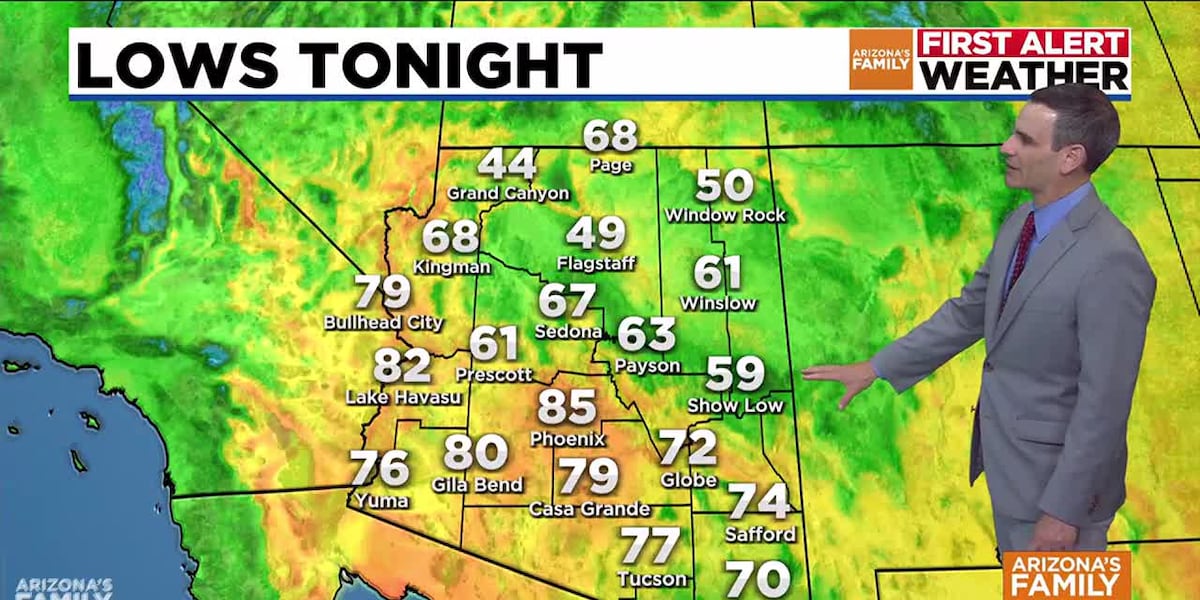
An isolated shower or thunderstorm is possible in the higher terrain east of Phoenix this evening. Otherwise, it will be dry with overnight lows dropping in the mid 80s by early Sunday morning.
Highs will reach near 105 degrees on Sunday which is exactly at normal for this time of year. Humidity will also be lower with dew points in the 40s on Sunday. For the sake of comparison, dew points were in the upper 50s to mid 60s for much of Saturday.
High temperatures will start to increase for the work week with 107 on Monday and 109 on Tuesday. There is a good chance we will go through a stretch of 110+ temperatures Wednesday through Friday as a ridge of high pressure builds. Some moisture will try to work its way back into our area by Friday into next weekend giving us a slight chance of rain in the Valley. Stay tuned for updates on those rain chances.
For the high country, some isolated showers will move through parts of the White Mountains and eastern Rim on Sunday, Monday, and Tuesday. Coverage of showers and storms will increase in the mountains by Wednesday through the end of the week as a push of moisture moves in.
See a spelling or grammatical error in our story? Please click here to report it.
Do you have a photo or video of a breaking news story? Send it to us here with a brief description.
Copyright 2025 KTVK/KPHO. All rights reserved.