Flash Flood warning issued for parts of Illinois
Flash Flood warning issued for parts of Illinois
03:04
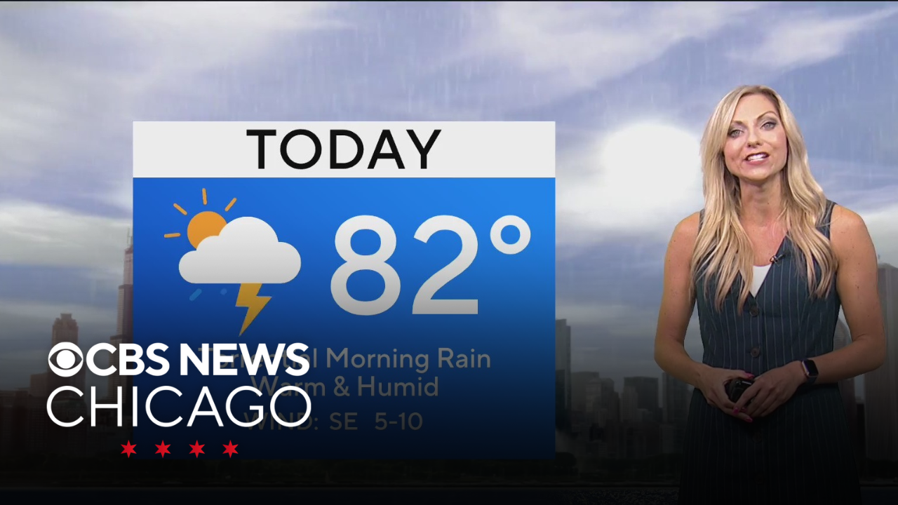
Rain showers and storms are still passing through early Sunday morning. Otherwise, a mainly cloudy sky.
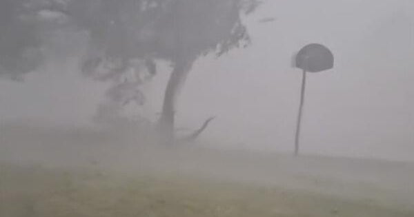
The National Weather Service has issued a Flash Flood warning for northern Iroquois, northeastern Grundy, Kankakee, southern Kendall, and southwestern Will counties that will remain in effect until 7:15 a.m.
High temperatures today with reach the lower to middle 80s, but it’ll feel closer to 90 degrees at times this afternoon. Most of the storms will diminish by the late morning, but we still can’t rule out having an isolated storm pop up during the afternoon. Tonight, temperatures drop into the lower 70s, but it’ll still feel very sticky with high humidity values.
CBS News Chicago is tracking scattered showers and storms through Tuesday, along with hot temperatures. After a final push of wet weather, breezy conditions return on Wednesday, but cooler conditions with highs in the 70s and 80s, depending on your location. Towards the end of the week, more sunshine and drier air, but the highlight will be lower humidity and slightly cooler temperatures.