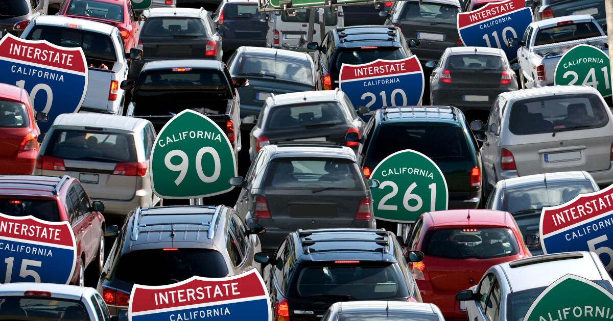
p]:text-cms-story-body-color-text clearfix”> 1. State Route 261
6.2 breezy miles connecting Irvine to State Route 241. Score: 654
Average speed: 66 mph (fastest out of 25)
Delays: 2nd least of 25 (scaled for total vehicle miles of travel)
Lost productivity: 2nd least out of 25 (scaled for total vehicle miles of travel)
Fatal crashes: 0 in 2022 (fewest out of 25, scaled for total vehicle miles of travel)

Aesthetics: This toll road is short, running only about six miles as an extension of the 241 toll road. But it gets drivers into the heart of Irvine’s business and shopping districts.
Freeway fact: The 261 was one of the roads where a group of YouTubers allegedly used to shoot clandestine street races, with speeds reaching 160 mph.
2. 90 Freeway
12.1 easy miles from Marina del Rey to Culver City, then from La Habra to Anaheim Hills. Score: 631
Average speed: 63 mph (3rd fastest out of 25)
Delays: fewest of 25 (scaled for total vehicle miles of travel)
Lost productivity: fewest out of 25 (scaled for total vehicle miles of travel)
Fatal crashes: 0 in 2022 (fewest out of 25, scaled for total vehicle miles of travel)

Aesthetics: One of California’s shortest freeways, it runs just a few miles from the 405 to Marina del Rey. It’s a bit cursed. It was supposed to run all the way to Orange County. And its original name — to honor Richard Nixon — was scrapped after Watergate. The Marina freeway never quite gets to the sailboats and waterside restaurants. Some activists want to close it and use the land for housing and parks.
Freeway fact: There is another tiny piece of the 90 Freeway in Yorba Linda. The city put aside scandal and named it the Richard Nixon Freeway in honor of the president who was born there and has his presidential library in town.
3. State Route 241
24.5 lovely miles from Yorba Linda to Rancho Santa Margarita. Score: 552
Average speed: 64 mph (2nd fastest out of 25)
Delays: 22nd most of 25 (scaled for total vehicle miles of travel)
Lost productivity: 21st most out of 25 (scaled for total vehicle miles of travel)
Fatal crashes: 2 in 2022 (20th most out of 25, scaled for total vehicle miles of travel)

Aesthetics: A good bit of this expressway cuts through the backcountry of Orange County, offering pleasant views of mountains and canyons.
Freeway fact: This Orange County toll road was a big deal when it opened. It offers an alternative for Inland Empire commuters trying to get into the job centers of Orange County. At the same time, it provided a freeway for the fast-growing foothill communities of south Orange County. But a plan to extend it through San Clemente was killed.
4. State Route 126
40.5 miles from Ventura to Santa Clarita. Score: 538
Average speed: 58 mph (16th slowest out of 25)
Delays: 17th most of 25 (scaled for total vehicle miles of travel)
Lost productivity: 2nd most out of 25 (scaled for total vehicle miles of travel)
Fatal crashes: 3 in 2022 (22nd most out of 25, scaled for total vehicle miles of travel)

Aesthetics: Much of Highway 126 has the feel of a country road as it winds along the Santa Clara River though such small towns as Fillmore, Piru and Santa Paula. It connects Santa Clarita with Ventura.
Freeway fact: State planners hoped to turn 126 into a full-fledged freeway, running from U.S. 101 all the way to Route 14. But only a few miles of freeway in Ventura County were completed. Eventually, the road made it to the 14, but only as a surface street.
5. 15 Freeway
293.6 miles from San Diego to the Nevada border. Score: 537
Average speed: 59 mph (17th slowest out of 25)
Delays: 14th most of 25 (scaled for total vehicle miles of travel)
Lost productivity: 6th most out of 25 (scaled for total vehicle miles of travel)
Fatal crashes: 77 in 2022 (18th most out of 25, scaled for total vehicle miles of travel)

Aesthetics: The freeway is an essential passageway for the booming Inland Empire. But let’s be honest, it’s best known as the road to Las Vegas.
Freeway fact: “There was only one road back to L.A. — U.S. Interstate 15. Just a flat-out high-speed burn through Baker and Barstow and Berdoo. Then onto the Hollywood Freeway, and straight on into frantic oblivion. Safety. Obscurity.” —Hunter S. Thompson
6. State Route 73
18 miles from San Juan Capistrano to Costa Mesa. Score: 480
Average speed: 63 mph (22nd slowest out of 25)
Delays: 21st most of 25 (scaled for total vehicle miles of travel)
Lost productivity: 13th most out of 25 (scaled for total vehicle miles of travel)
Fatal crashes: 1 in 2022 (23rd most out of 25, scaled for total vehicle miles of travel)

Aesthetics: Originally the short Corona del Mar Freeway, it was extended in the 1990s as the San Joaquin Hills toll road to San Juan Capistrano. It cuts through picturesque coastal hills and the northbound drive offers stunning views of Catalina Island, the Pacific, mountain ranges and Orange County. But you have to pay to enjoy. Some people are willing to cough up the dough to avoid traffic on the 5 Freeway.
Freeway fact: Orange County’s first full toll road, it once had a toll plaza at the top of the hill called “Catalina View.”
7. State Route 118
48 miles from Ventura to Lake View Terrace. Score: 317
Average speed: 61 mph (20th slowest out of 25)
Delays: 19th most of 25 (scaled for total vehicle miles of travel)
Lost productivity: 19th most out of 25 (scaled for total vehicle miles of travel)
Fatal crashes: 17 in 2022 (14th most out of 25, scaled for total vehicle miles of travel)

Aesthetics: The 118 runs on the northern end of the San Fernando Valley, past the Santa Susanna Mountains and into Simi Valley and Ventura County. Look carefully while driving west on the 118 in Santa Susanna, crossing Kuehner Drive, and you may spot “Happy Face Hill” where a massive happy face has been tilled onto a hillside.
Freeway fact: It was originally known for parts of its route as the “Simi Valley Freeway” but later was rebranded the “Ronald Reagan Freeway” to mark the opening of his presidential library in Simi Valley.
8. State Route 71
16.5 miles from Corona to Pomona. Score: 288
Average speed: 60 mph (19th slowest out of 25)
Delays: 20th most of 25 (scaled for total vehicle miles of travel)
Lost productivity: 9th most out of 25 (scaled for total vehicle miles of travel)
Fatal crashes: 5 in 2022 (16th most out of 25, scaled for total vehicle miles of travel)

Aesthetics: This picturesque suburban freeway runs roughly from Pomona to Corona and goes by two names: The Chino Valley Freeway and the Corona Freeway.
Freeway fact: The 71 begins at the bicentennial mural at the Prado Dam and ends at the Kellogg Interchange, a stately traffic machine that connection the 57, 10 and 71.
9. State Route 170
7.6 miles between Toluca Lake and Sun Valley. Score: 147
Average speed: 62 mph (21st slowest out of 25)
Delays: 23rd most of 25 (scaled for total vehicle miles of travel)
Lost productivity: 22nd most out of 25 (scaled for total vehicle miles of travel)
Fatal crashes: 5 in 2022 (4th most out of 25, scaled for total vehicle miles of travel)

Aesthetics: You might wonder if the 170 has a bit of impostors syndrome. After all, it has the lofty name “Hollywood Freeway” without the luster. No, the 101 gets all the love. The 170 was built as an extension of the 101, beginning in Studio City when the 101 turns west as the Ventura Freeway and moving north through the Valley floor until it ends at the 5. In the days of radio traffic reports, the 101-170 interchanges was called the “Hollywood Split.”
Freeway fact: Three 12-foot-tall, brightly colored metal figures dubbed “Drive-by Art” were installed along the Sherman Way exit in 1992 but were mowed down two years ago by a wayward motorist. They have since been restored.
10. 5 Freeway
132.9 miles of frustration from Santa Clarita to San Clemente (extends from Mexico to Canada). Score: 132
Average speed: 56 mph (10th slowest out of 25)
Delays: 11th most of 25 (scaled for total vehicle miles of travel)
Lost productivity: 15th most out of 25 (scaled for total vehicle miles of travel)
Fatal crashes: 83 in 2022 (5th most out of 25, scaled for total vehicle miles of travel)

Aesthetics: The 5 Freeway is as close as Southern California has to a mother road. It’s a commuter highway and an escape route of L.A. for travel north and south (it spans from the Mexican border to the Canadian border). The freeway carved up the Eastside, and longtime locals are still angered about it.
Freeway fact: The 5 is known as the “Golden State Freeway” through much of L.A. County and the “Santa Ana Freeway” south of downtown. But when it heads into the mountains toward the Central Valley, it is often called the “Ridge Route” or “Grapevine.” In south Orange County, it becomes the “San Diego Freeway.”
11. State Route 134
13.3 miles from Toluca Lake to Pasadena. Score: 113
Average speed: 58 mph (15th slowest out of 25)
Delays: 16th most of 25 (scaled for total vehicle miles of travel)
Lost productivity: 16th most out of 25 (scaled for total vehicle miles of travel)
Fatal crashes: 1 in 2022 (21st most out of 25, scaled for total vehicle miles of travel)

Aesthetics: The 134 runs along some scenic parts of L.A., including below the famed Eagle Rock. That stretch offers some of the most dramatic L.A. views you can get on a freeway, including glimpses of the Pacific on a clear day.
Freeway fact: A portion of the freeway was named in honor of Barack Obama because the former president attended Occidental College, which is near but not all that close to the 134.
12. State Route 22
14.7 miles from Long Beach to Orange. Score: 10
Average speed: 58 mph (14th slowest out of 25)
Delays: 15th most of 25 (scaled for total vehicle miles of travel)
Lost productivity: 20th most out of 25 (scaled for total vehicle miles of travel)
Fatal crashes: 6 in 2022 (12th most out of 25, scaled for total vehicle miles of travel)

Aesthetics: The Garden Grove Freeway cuts through the heart of central Orange County, connecting Long Beach with Orange. It’s one way to reach Disneyland, Little Saigon and (back in the day) Robert Schuller’s Cyrstal Catheral church complex. It also made history when the freeway added exit signs for Little Saigon.
Freeway fact: One joker on Facebook told the story of a driver stopped by an officer because she was driving far too slowly on the freeway. “The officer containing a chuckle explains that 22 was the route number, not the speed limit.”
13. 105 Freeway
18.1 miles from El Segundo to Norwalk. Score: -2
Average speed: 59 mph (18th slowest out of 25)
Delays: 18th most of 25 (scaled for total vehicle miles of travel)
Lost productivity: 23rd most out of 25 (scaled for total vehicle miles of travel)
Fatal crashes: 12 in 2022 (3rd most out of 25, scaled for total vehicle miles of travel)

Aesthetics: The last major interstate in metro Los Angeles, the 105 marked the end of the freeway building era and included nods to the impacts those roads were having on life and the environment. The expensive 105 included a light rail line down the center and was built below the ground level of surrounding communities to reduce the noise impacts.
Freeway fact: The 105 was intended to connect with the 5 in Norwalk but Caltrans stopped about a mile and a half short, saying the 5 couldn’t handle the added traffic.
14. 210 Freeway
85.6 miles from Santa Clarita to Redlands. Score: -16
Average speed: 55 mph (7th slowest out of 25)
Delays: 7th most of 25 (scaled for total vehicle miles of travel)
Lost productivity: most out of 25 (scaled for total vehicle miles of travel)
Fatal crashes: 12 in 2022 (19th most out of 25, scaled for total vehicle miles of travel)

Aesthetics: Much of the 210 Freeway hugs the base of the San Gabriel Mountains, hence its name: Foothill Freeway. La Cañada Flintridge fought the freeway for years, with locals calling it the “Dragon of Destruction.” But the city was no match for freeway planners.
Freeway fact: In an infamous piece of seismic history, portions of the Foothill/Golden State Freeway collapsed during the 1971 Sylmar quake.
15. 215 Freeway
55.1 miles between Murrieta and San Bernardino. Score: -50
Average speed: 57 mph (11th slowest out of 25)
Delays: 12th most of 25 (scaled for total vehicle miles of travel)
Lost productivity: 10th most out of 25 (scaled for total vehicle miles of travel)
Fatal crashes: 27 in 2022 (9th most out of 25, scaled for total vehicle miles of travel)

Aesthetics: The 215 is an eastern bypass of Interstate 15 that runs roughly from Murrieta to Devore. Talk about identity crisis: This freeway was once named US Route 395, renumbered as I-15 E, changed to State Route 194, then dubbed State Route 215 until it finally took the moniker I-215.
Fun fact: The 60-91-215 freeway interchange was considered one of the worst in California, both in terms of accidents and delays. A massive rebuilding and modernization project completed in 2007 aimed to make life easier for commuters.
16. 101 Freeway
83.1 winding miles from Boyle Heights to Ventura (continues to Washington state). Score: -102
Average speed: 54 mph (3rd slowest out of 25)
Delays: 3rd most of 25 (scaled for total vehicle miles of travel)
Lost productivity: 12th most out of 25 (scaled for total vehicle miles of travel)
Fatal crashes: 37 in 2022 (10th most out of 25, scaled for total vehicle miles of travel)

Aesthetics: Few freeways cut through the heart of existing L.A. more dramatically than the 101, carving a destructive path through Boyle Heights, the Civic Center, Echo Park, Silver Lake, Hollywood and through the Cahuenga Pass into the Valley. The scorched-earth design makes for a fast sprint, except it’s very often gridlocked. The Times called it L.A.’s ultimate freeway, “a telegenic mix of glamour, grit and gridlock.”
Freeway fact: You can still see evidence of a planned but never built interchange in Hollywood between the 101 and the canceled Beverly Hills Freeway.
17. State Route 55 (Costa Mesa Freeway)
17.9 miles connecting Newport Beach to Orange. Score: -180
Average speed: 57 mph (12th slowest out of 25)
Delays: 10th most of 25 (scaled for total vehicle miles of travel)
Lost productivity: 11th most out of 25 (scaled for total vehicle miles of travel)
Fatal crashes: 6 in 2022 (15th most out of 25, scaled for total vehicle miles of travel)

Aesthetics: Running from Newport Beach to Anaheim Hills, the 55 goes entirely through Orange County. It is close to the South Coast Plaza/Costa Mesa business district as well as John Wayne Airport.
Freeway fact: It was originally called the “Newport Freeway” back when dreamers hoped it would make it all the way to the upscale coastal town. But it never did and is now called the “Costa Mesa Freeway.”
18. State Route 60 (Pomona Freeway)
70.6 miles connecting East L.A. and Beaumont. Score: -190
Average speed: 56 mph (8th slowest out of 25)
Delays: 9th most (scaled for total vehicle miles of travel)
Lost productivity: 5th most (scaled for total vehicle miles of travel)
Fatal crashes: 30 in 2022 (11th most, scaled for road length)

Aesthetics: The boom in suburbia after World War II made moving all those cars into downtown L.A. essential. Enter the 60 Freeway, which pushed east along with all those housing tracts and shopping centers.
Freeway fact: A 2015 study concluded that residents living in an Ontario neighborhood near the 60 Freeway had the dubious distinction of breathing the dirtiest air in Southern California due to traffic pollution.
19. State Route 57 (Orange Freeway)
24.1 miles of frustration from Orange to Glendora. Score: -190
Average speed: 57 mph (13th slowest out of 25)
Delays: 13th most (scaled for total vehicle miles of travel)
Lost productivity: 4th most (scaled for total vehicle miles of travel)
Fatal crashes: 7 in 2022 (17th most, scaled for road length)

Aesthetics: A suburban thoroughfare, the Orange Freeway connects central Orange County to Glendora and the eastern San Gabriel Valley. It carries motorists past Angel Stadium and Honda Center and offers lovely views of Brea Canyon and hillside communities.
Freeway fact: It’s part of the dreaded “Orange Crush” interchange that connects the 57, 5 and 22 and was supposed to continue south along the Santa Ana River to Huntington Beach. But those plans never materialized.
20. 110 (Harbor) Freeway
31.8 miles connecting San Pedro to Pasadena. Score: -350
Average speed: 54 mph (4th slowest out of 25)
Delays: 6th most (scaled for total vehicle miles of travel)
Lost productivity: 18th most (scaled for total vehicle miles of travel)
Fatal crashes: 17 in 2022 (7th most, scaled for road length)

Aesthetics: In a sea of epithets and complaints, Angelenos have a soft spot for their first true freeway. It’s so quaint and cute, curving through the Arroyo Seco from Chinatown to Pasadena, like a country road in the middle of the city. In the other direction, the freeway extends all the way to San Pedro as the “Harbor Freeway.” Long known as the “Pasadena Freeway,” the 110 north of downtown won its own name (“Arroyo Seco Parkway”) back a few years ago as part of beautification plan that included new vintage-style street lighting.
Freeway fact: Some of us can’t think about this freeway without humming “Little Old Lady From Pasadena,” the ‘60s Jan and Dean song that celebrated V8 Dodges and also a now-forgotten piece of postwar L.A. car culture.
21. 710 (Long Beach) Freeway
24.2 grinding miles from Long Beach to Alhambra. Score: -450
Average speed: 54 mph (5th slowest out of 25)
Delays: 4th most (scaled for total vehicle miles of travel)
Lost productivity: 17th most (scaled for total vehicle miles of travel)
Fatal crashes: 19 in 2022 (2nd most, scaled for road length)

Aesthetics: The 710 Freeway is the shoulder on which Southern California’s commerce rests. Countless trucks filled with goods crawl between the port complex in Long Beach to inland logistics centers and retailers. For much of its route, the freeway follows the Los Angeles River.
Freeway fact: Early maps of the 710 called it the “Truck Freeway,” a nod to its role in the local economy. It was also the subject of a decades-long (and successful) fight by resident to prevent an extension reaching into Pasadena.
22. State Route 91 (Riverside Freeway)
59.1 slow miles from Long Beach to Buena Park. Score: -470
Average speed: 56 mph (9th slowest out of 25)
Delays: 8th most (scaled for total vehicle miles of travel)
Lost productivity: 7th most (scaled for total vehicle miles of travel)
Fatal crashes: 35 in 2022 (6th most, scaled for road length)

Aesthetics: The freeway is a key route through L.A., Orange and Riverside counties. Congestion through Santa Ana Canyon was so bad it spawned paid express lanes.
Freeway fact: It is also a freeway of many names: The Gardena Freeway in the South Bay. The Artesia Freeway in Southeast L.A. County and the Riverside Freeway further east. It was also known as the Redondo Beach Freeway back in the day planners hoped to push it all the way to PCH. In the Inland Empire, signs say you are headed to “Beach Cities” even though the freeway ends many miles inland.
23. 405 Freeway
72.8 miles of frustration from San Fernando to Irvine. Score: -500
Average speed: 53 mph (2nd slowest out of 25)
Delays: 2nd most (scaled for total vehicle miles of travel)
Lost productivity: 14th most (scaled for total vehicle miles of travel)
Fatal crashes: 28 in 2022 (13th most, scaled for road length)

Aesthetics: Perhaps no freeway is as hated as the 405. Those three numbers say so much. It runs through some of Southern California’s key hubs — the Westside, Valley, South Bay, Long Beach, Orange County — but the traffic is so bad the route rarely feels convenient. Still, motorists who crest the Sepulveda Pass heading east get a sparkling panoramic view of the San Fernando Valley at night.
Freeway fact: The 405 has inspired songs, from Beyonce and Miley Cyrus (“I’ll be your shotgun rider ‘til the day I die Smoke out the window flyin’ down the 405”) to the Gin Bloosoms (“Dead or alive on the 405 / Traffic’s moving like a slug / Dead or alive on the 405 / Stuck behind a ’68 bug.”
24. 605 (San Gabriel River) Freeway
A notoriously jammed road spanning 28.1 miles from Long Beach to Duarte. Score: -600
Average speed: 54 mph (6th slowest out of 25)
Delays: 5th most (scaled for total vehicle miles of travel)
Lost productivity: 3rd most (scaled for total vehicle miles of travel)
Fatal crashes: 15 in 2022 (8th most, scaled for road length)

Aesthetics: This freeway follows the San Gabriel River and cuts through many of eastern L.A. County old ring suburbs. Landmarks include El Dorado Park in Long Beach, the Los Cerritos mall, Rose Hills Cemetery, the mighty Santa Fe Dam and the City of Hope medical complex.
Freeway Fact: The 605 Freeway connects the small towns of Duarte and Seal Beach, but neither destination appears on freeway signage.
25. 10 Freeway
46.8 nightmarish miles from the ocean through the city. Score: -1300
Average speed: 52 mph (slowest out of 25)
Delays: Worst of 25 (scaled for total vehicle miles of travel)
Lost productivity: 8th most (scaled for total vehicle miles of travel)
Fatal crashes: 90 in 2022 (Worst of 25, scaled for length of road)

Aesthetics: One of the workhorses of the interstate highway system, the 10 runs coast to coast from Santa Monica to Jacksonville, Fla. It is a key route through Los Angeles, and offers beautiful views both of Hollywood and Koreatown westbound and downtown’s skyline eastbound. It has a special place in the history of freeways: Some of the first carpool lanes in California were added there in the 1970s, sparking one of the biggest traffic revolts L.A. has ever seen.
Freeway Fact: The 10 was known as the Christopher Columbus Transcontinental Highway, with a big sign in Santa Monica. But the name was removed a few years ago. A small stretch of freeway is named after Rosa Parks.
Methodology: The Times pulled data from Caltrans PeMS for each freeway in both directions over a one-year period, limiting the results to stretches in Southern California counties. The four metrics — Q (or VMT/VHT), hours of delay assuming 60 mph, productivity loss assuming 60 mph and number of fatal crashes — were weighted to produce quality scores for each freeway. Where possible, freeways were limited to Caltrans District 7 (Los Angeles and Ventura counties), District 8 (Riverside and San Bernardino counties) and/or District 12 (Orange County). Traffic fatality data came from the California Strategic Highway Safety Plan (SHSP) Crash Data Dashboard. These metrics were weighted to produce a symmetrical point score for each freeway, such that about half of freeways had positive scores and half had negative scores overall.