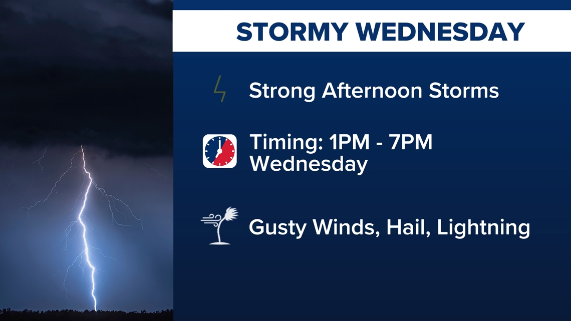
Strong afternoon storms could include gusty winds, hail and lightning.
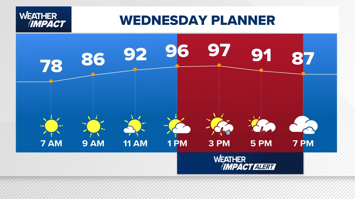
HOUSTON — Get ready for more storms on Wednesday. That’s why the KHOU 11 Weather Team has issued an hourly Weather Impact Alert that is in effect from 1 p.m. through 7 p.m. for the Houston area.
After a quiet Tuesday evening, Wednesday morning will be sunny and partly sunny. But then the atmosphere will heat up into the upper 90s Wednesday before storms fire up. With plenty of heat and humidity in place, conditions are favorable for widespread thunderstorms Wednesday afternoon into the early evening.
What to expect Wednesday:
- Timing: 1 p.m. – 7 p.m. (Weather Impact Alert in effect)
- Threats: Heavy rain, strong straight-line winds, frequent lightning, possible small hail
- Impacts: Evening commute delays, outdoor activities or practices could be canceled
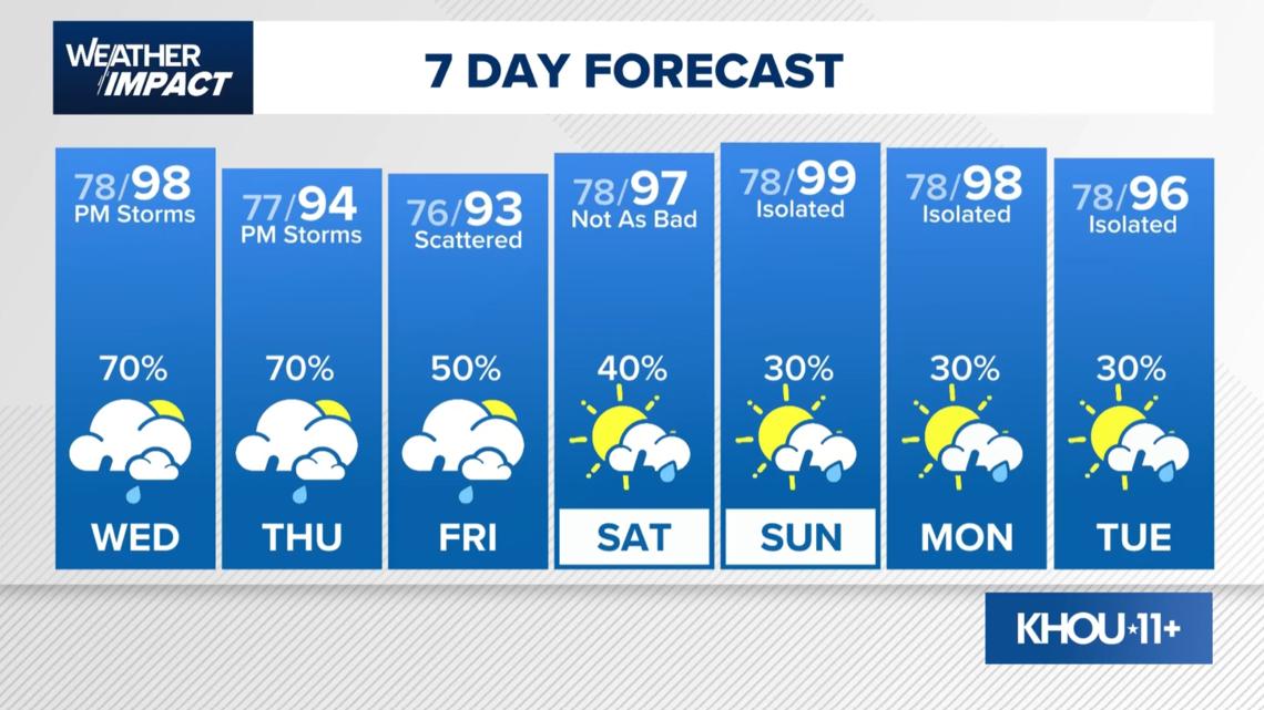
After we get through Wednesday, we’re not done with the rain and storms. We have a 70% chance of more on Thursday and Friday.

And the stormy pattern doesn’t end there. Scattered thunderstorms are possible Friday, with a 50% chance of showers and storms. The rain chances gradually tapering off after that.
Urgency & threat level
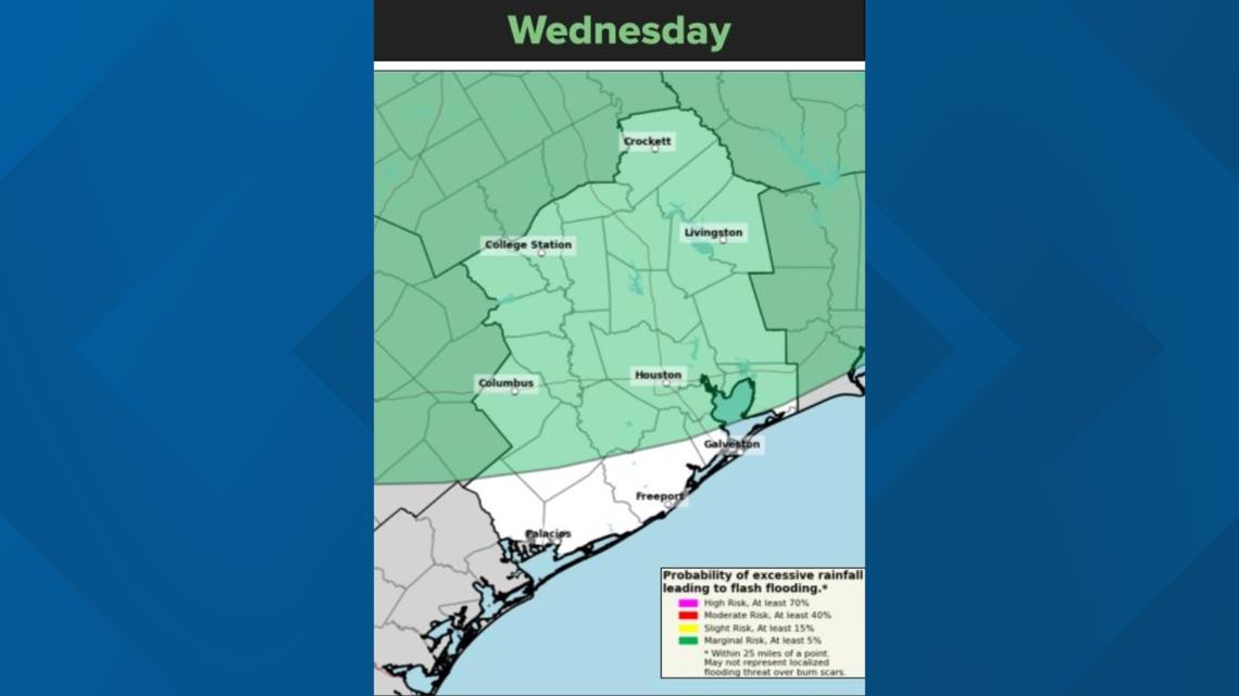
There is a marginal risk (level 1 of 4) for excessive rainfall on Wednesday and Thursday.
Minor flooding could happen if repeated strong storms move over the same area.
Most of the Houston-area counties are included in the risk for excessive rainfall Wednesday, except for a sliver along the coast.

What to do
- Set alerts on your phone before heading out this afternoon
- Avoid low-lying roads during the evening commute
- Prep early if your area is flood-prone — move vehicles, clear drains, and avoid parking under trees
Even if storms look scattered, the high moisture content means any single downpour could quickly cause trouble.
Looking ahead
Thursday has a 70% chance of storms.

For continuous live updates, watch extended weather coverage anytime on KHOU 11+.