What to Know
- Hurricane Erin is passing offshore along the East Coast on Thursday, Aug. 21.
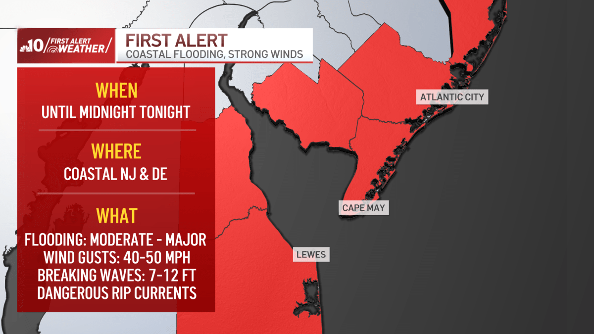
- A First Alert is in effect for the Jersey Shore and Delaware beaches from 6 a.m. to midnight.
- The greatest threats to these communities are flooding and strong 40 to 50 m.p.h. wind gusts. Surf conditions are expect to reach seven to 12 feet breaking along the coast. The threat of dangerous, life-threatening rip currents will continue.
- High tide Thursday around 6 a.m. will bring minor flooding but the tide will be running even higher later during the day.
- The biggest flood threat will occur Thursday night at high tide along the Jersey Shore and Delaware Bay coastlines, including Cumberland and Cape May counties and Kent and Sussex counties in Delaware. The National Weather Service issued a Flood Warning for parts of the Jersey Shore and Delaware until 2 a.m. Saturday.
- Get the latest updates on Hurricane Erin by downloading the NBC10 app and following the NBC10 First Alert Weather team.
A First Alert has been issued for the Jersey Shore and coastal Delaware for Thursday, Aug. 21, from 6 a.m. to midnight as Hurricane Erin passes offshore along the East Coast and brings flooding and strong winds.
Follow along below for the latest updates.