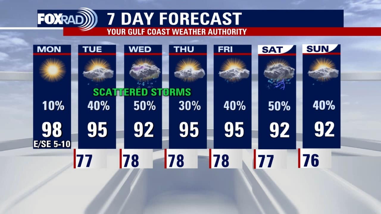
HOUSTON – It’s pretty quiet Monday morning, but will soon grow to be sunny and hot with highs in the mid to upper 90s. Ozone could be unhealthy for sensitive groups.
Quiet start to the week
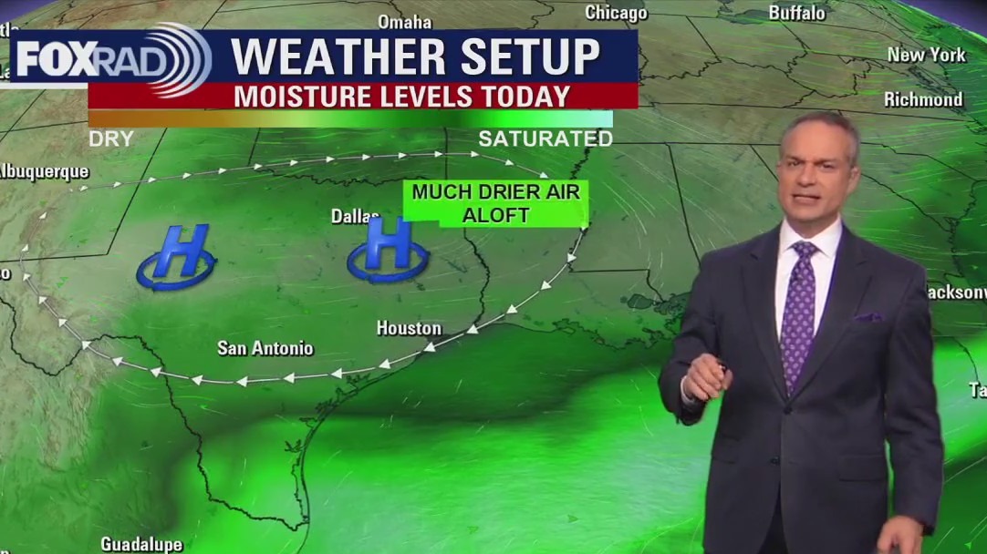
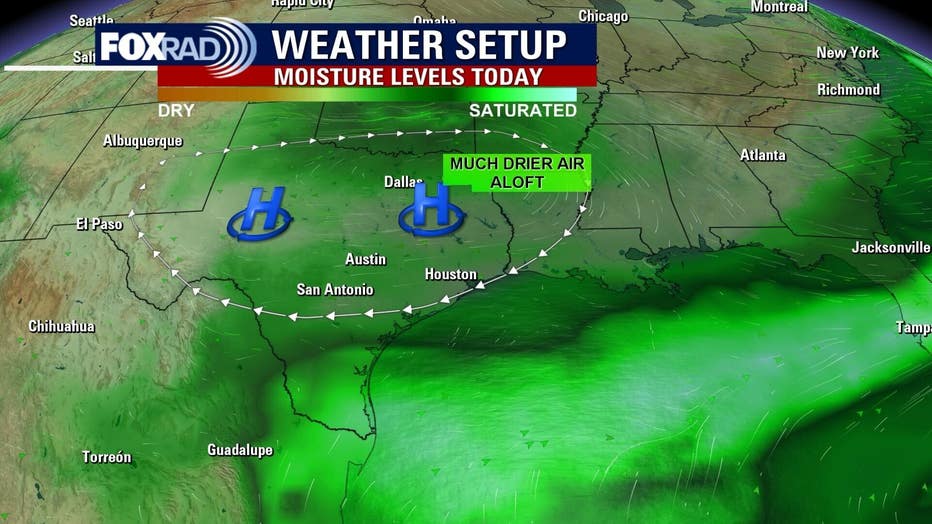
High pressure will bring more sunny and hot weather to the Houston area today with high temperatures in the upper 90s inland and low 90s near the beaches.
One issue will be with air quality, especially ozone pollution. Ozone is rarely a noticeable problem when it reaches level orange, but can be a concern for those with conditions like asthma, so just avoid overdoing it outdoors this afternoon.
Daily afternoon rain returns 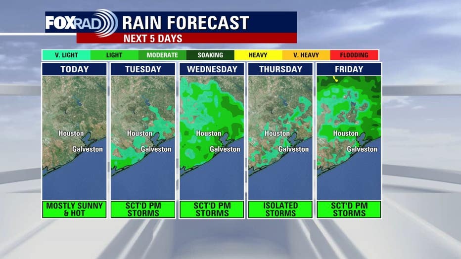
As high pressure shrinks and moves westward tomorrow, expect scattered afternoon storms. This pattern should stay in place for the rest of the week and into this weekend, so expect highs in the low to mid 90s with a daily scattering of storms during the typical times after about 1 p.m.
A tropical storm and a tropical wave
The season’s sixth tropical storm is not much of a story in the middle of the Atlantic Ocean. It has avoided any land and is a small system with winds near 50 mph.
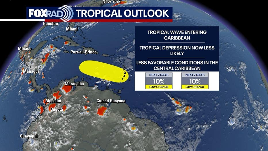
It will move to the north and northeast, likely dissipating by Wednesday or Thursday. Elsewhere, a tropical wave just entering the Caribbean doesn’t look impressive and is unlikely to get stronger. We will still monitor it closely for any changes.
The Source: Your Gulf Coast Weather Authority