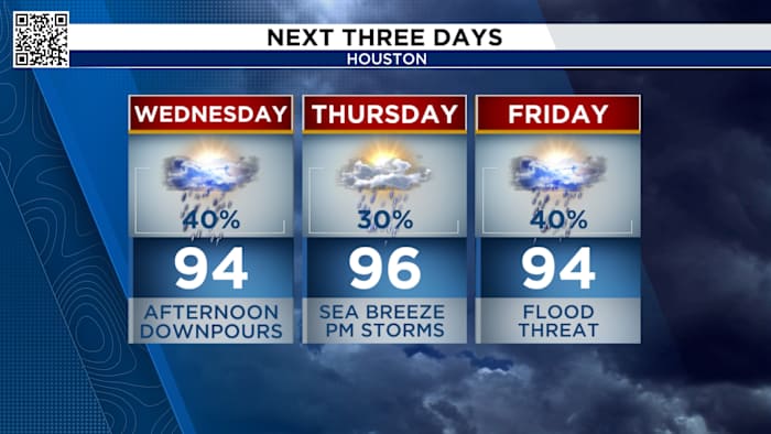
Houston could see a few spotty showers for early risers Wednesday morning, but the main round of rain is expected later in the day. Forecasters warn that downpours may build by late afternoon, creating a soggy drive home for commuters.
Rain chances increasing:
Rain chances move back up for the rest of the week with a stalled front sitting between Dallas and Houston. Expect to see scattered downpours each afternoon starting Tuesday through the Labor Day weekend.
Wednesday Afternoon
There is a low flood threat for Friday and Saturday for all of SE Texas. This means some storms could produce heavy downpours that lead to ponding in roadways. Plan on extra time on the roads.
Flood ThreatTropical Outlook:
Tropical Storm Fernand formed Saturday evening- the 6th named storm of the 2025 hurricane season. This storm is not a threat to land and is moving out into the north Atlantic.
Tropical Storm Fernand (Copyright 2025 by KPRC Click2Houston – All rights reserved.)
Otherwise there are no regions for possible development. There is are no tropical threats to the Gulf at this time. Cherish this moment, it’s rare for late-August.
Tropical Outlook (Copyright 2025 by KPRC Click2Houston – All rights reserved.)
Make sure your family is prepared for whatever comes our way this hurricane season. You can check out our 2025 Hurricane and Flood Survival Guide here.
Your extended forecast:
Keep the umbrellas handy as daily showers and storm chances continue. A second front will head into the region for much of the Labor Day Weekend, unfortunately, bringing rain chances up again for both Saturday and Sunday.
10 Day Forecast
If you notice interesting weather in your neighborhood, share your photos and videos with KPRC 2 at Click2Pins!
Anthony’s Weather Lab
More Stories Like This In Our Email Newsletter
Copyright 2025 by KPRC Click2Houston – All rights reserved.
