
DALLAS – North Texas is bracing for a late-season return to summer heat before a series of fronts bring back cooler temperatures, with a chance for strong storms and even some tropical remnants through the end of August and the weekend.
The morning chill that has kept temperatures pleasant is beginning to recede as a warm front lifts north, generating scattered showers east and northeast of the Dallas-Fort Worth area. By afternoon, skies are expected to clear, allowing temperatures to climb back above 90 degrees for many, though areas to the north and east will stay in the cooler air longer. The rising humidity will push the afternoon heat index into the mid-90s.
Thursday Forecast
Thursday will be hot and humid, with highs forecast to reach the mid to upper 90s, accompanied by a south-southwest breeze. With dewpoints near 70, the afternoon heat index is projected to feel between 102 and 104 degrees.
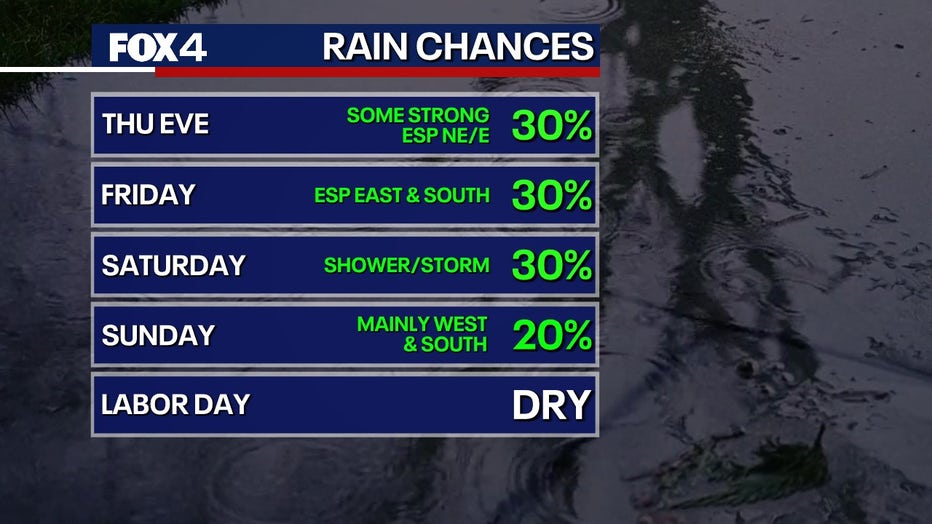
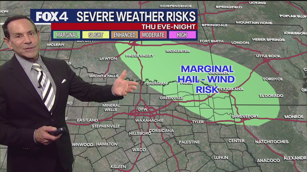
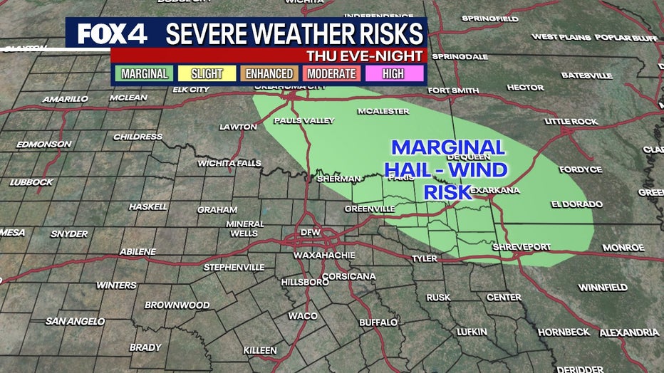
A quick change is expected by sunset as a cold front from Oklahoma and Arkansas moves through. The greatest threat for strong to marginally severe storms, capable of producing wind and hail, will be in northeast Texas and the Ark-La-Tex region. Weaker storms are possible for the Metroplex overnight.
Friday Forecast
Friday will see temperatures return to the 80s for most areas, with north winds and clouds accompanying the cold front. The best chances for showers and storms will be east and south of the Metroplex. The cooler air will hold through the weekend as meteorological summer concludes.
Saturday Forecast
On Saturday, the remnants of Tropical Storm Juliette are forecast to move through the state, bringing additional clouds and showers that will help keep high temperatures in the mid-80s. Sunday’s forecast calls for a weaker disturbance, with the most unstable air remaining west and south of the DFW area, keeping shower chances low. The outlook for Labor Day and Tuesday is more favorable, with a drier air mass and a good amount of sun, leading to comfortable mornings and warm afternoons.
7-Day Forecast 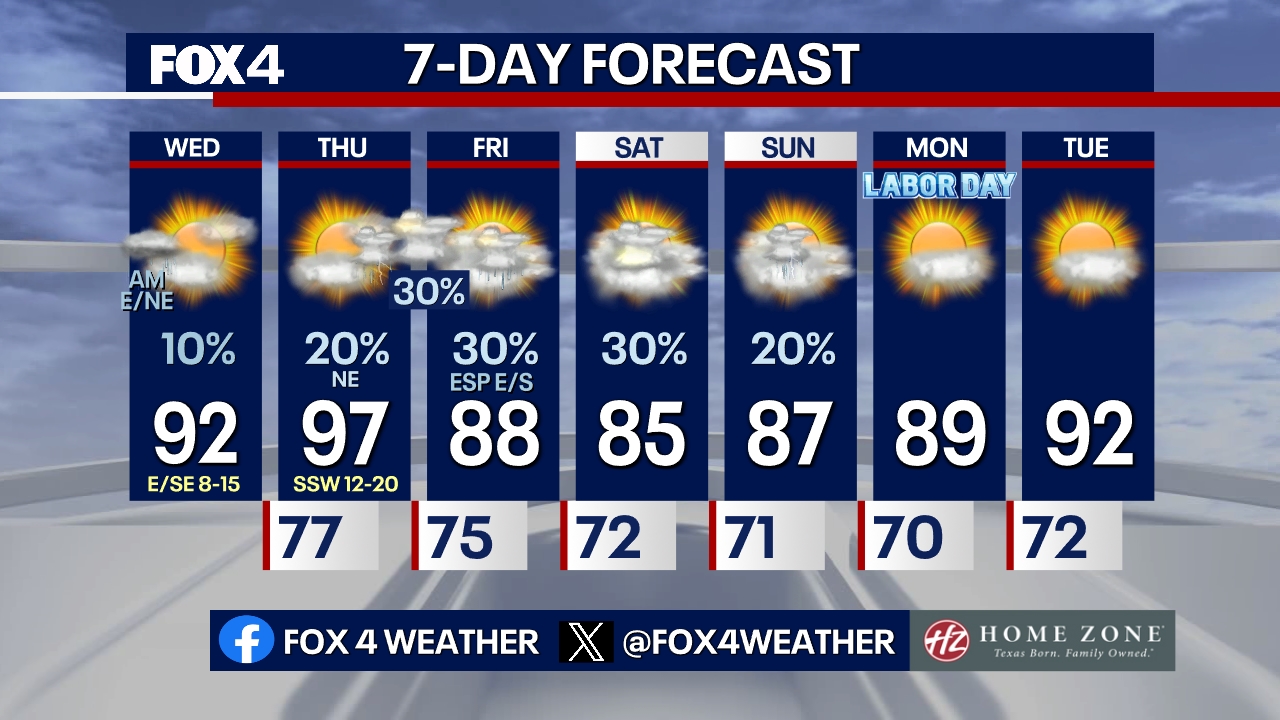 Live Radar
The Source: Information in this article is from the FOX 4 News Weather Team.