On-and-off showers and storms could shake up Labor Day plans for some
JACKSONVILLE, Fla. – Jacksonville is in the midst of a classic pattern: showers and storms that move in quickly, clear just as fast, and leave all of us guessing when the next downpour might arrive. The Weather Authority’s cameras caught rain sweeping across spots like Jacksonville Beach and Morningstar Marinas, only to have clouds give way to brighter, calmer moments just minutes later.
According to Radar First Alert graphics from Exact Track 4D and observations from live cameras, some areas—like the marinas—have seen rain paired with breezy conditions, while beaches cleared rapidly and folks enjoyed the return of dry skies. Showers are expected to pop up on and off today; it’s definitely not a statewide washout, but you’ll want to keep an umbrella handy just in case.
The National Weather Service has issued a statement about locally heavy rain possible this afternoon. Areas most affected may also see wind gusts and some lightning. As we’ve seen, not all showers are showing up on radar, so don’t let the weather maps be your only guide—sometimes those quick storms sneak in unannounced.
Neighborhood-by-neighborhood: a tale of two weather stories
One thing’s for sure: the weather’s been changing fast. From sunny stretches to the occasional thunderstorm, it’s been different from one neighborhood to the next. The beach crowd held out while rain clouds passed overhead, proving that patience sometimes pays off on days like this. Over in World Golf Village, skies stayed dry and little evidence of rain could be seen, even while surrounding areas picked up showers.
St. Augustine and nearby marinas have also seen some on-and-off rain, but many locations have simply been dealing with overcast skies and the occasional breeze. It all comes down to where these pop-up showers decide to track, and sometimes your drive or walk to another part of town shifts the weather story entirely.
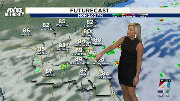
Labor Day forecast: rain chances ease, but eyes on the sky
There’s some good news heading into Labor Day: rain chances are now expected to be lower than what computer models showed last week. While the earlier outlook suggested much of the weekend would be a washout, Exact Track 4D models now show that passing showers and storms are more likely to be scattered.
A few afternoon downpours or thunderstorms are still in the cards, with some areas likely to pick up more rain than others—especially during the heating of the day. Temperatures are forecast to sit in the 80s with humidity levels staying summer-like.
Don’t forget: whenever you see remarkable weather in your neighborhood, you can share photos and videos with the News4JAX team through SnapJAX and join the Weather Authority in capturing this unpredictable Labor Day weekend.
Copyright 2025 by WJXT News4JAX – All rights reserved.