Rainfall totals ranged from 1 to 4 inches across the region
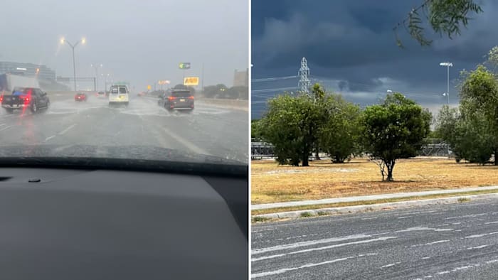
KSAT Connect users share photos of heavy rain and dramatic cloud formations on Sunday, Aug. 31, 2025. (KSAT)
SAN ANTONIO – Heavy rain swept through San Antonio Sunday evening, triggering a Flood Watch and warnings. The downpours caused localized flooding in low-lying areas.
Storms developed along a stalled front and moved slowly southward, producing intense downpours, frequent lightning and wind gusts up to 50 mph. Rainfall totals ranged from 1 to 4 inches across the region.
Whatever the Weather
A collection of daily blog posts from the KSAT Weather Authority.
Precautionary gate closures were implemented in areas like Olmos Basin due to flood risks.
Have any photos of Sunday’s rain? Submit them to KSAT Connect for a chance to be featured on-air or online.
Below are photos and videos shared by KAST viewers that captured dramatic cloud formations, sheets of rain and rising water levels in streets and streams.
Stalled vehicles and Flooding on 281 S Bound before San Pedro
You can find the latest forecast of the storms here.
Copyright 2025 by KSAT – All rights reserved.
About the Authors