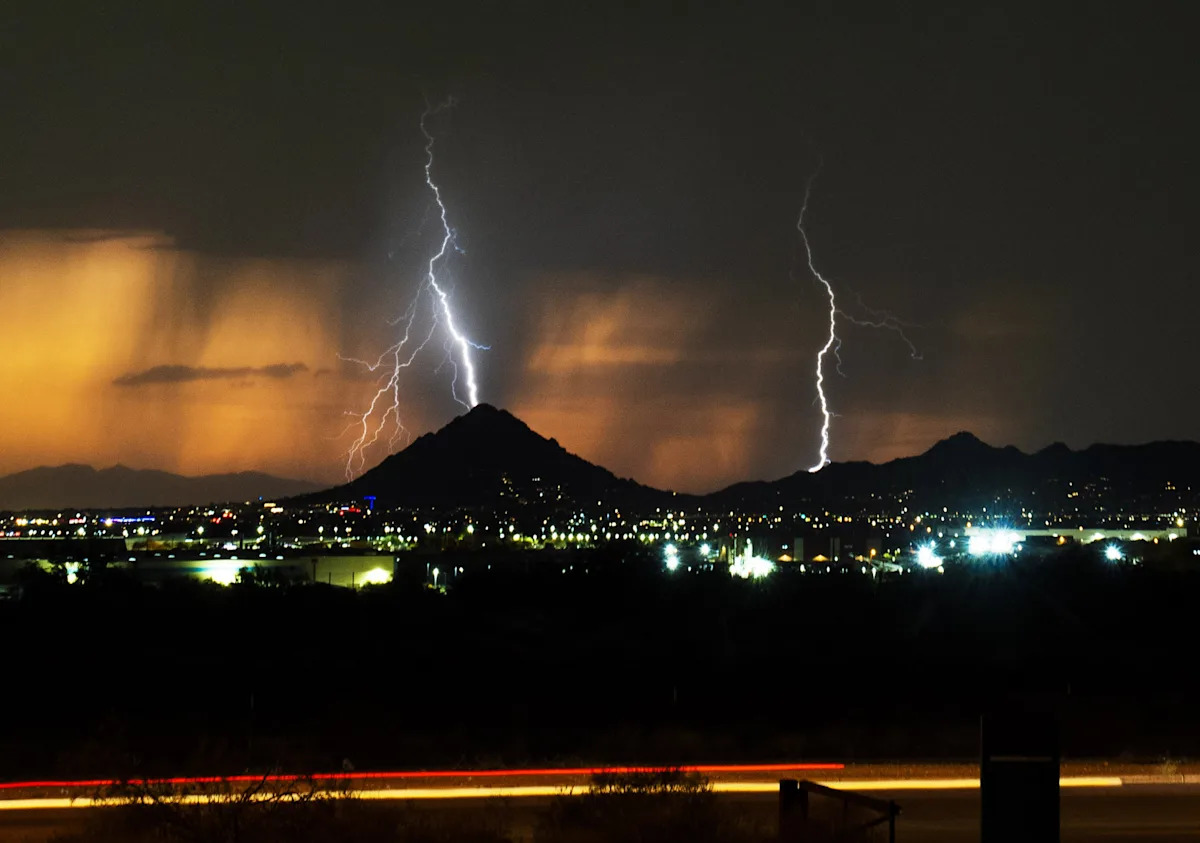
After a string of triple-digit days, Phoenix is about to cool down, and storm chances are back in the forecast.
Rain chances will tick upward as moisture pushes into the region.
“There will be chances of thunderstorms throughout the week,” said Mark O’Malley, meteorologist with the National Weather Service in Phoenix. “The best chances are coming in on Thursday and Friday, with chances in the Phoenix metro area up to 50%.”
The area could see gusty winds, localized blowing dust and heavy rainfall.
With about a month of the monsoon remaining, Phoenix is still short of its 2.43-inch rain average for the whole season. The weather station at Sky Harbor International Airport has recorded half an inch of rain so far.
Late-season monsoonal moisture will bring slightly below-average temperatures this week, as highs will hover in the low to mid-90s.
Storm chances taper off by Saturday, Sept. 6, and drier air will return, sending high temperatures up again to the upper 90s and low 100s next week.
“It will warm up again towards the beginning of next week and get back towards seasonal normals,” O’Malley said.
Season in review: Summer in Phoenix was hot, but was it a record breaker?
Flood safety tips
-
Never drive into flooded roadways
-
Avoid low-lying washes and underpasses
-
Keep updated on alerts from the National Weather Service
-
Watch for rapid rises in creeks, streams and normally dry washes
Dust storm safety tips
-
If you encounter a dust storm on the road, pull off as far as possible
-
Turn off the lights and keep your foot off the brake
-
Remain in your vehicle with your seatbelt fastened
-
Wait until the storm passes before continuing travel
Wall of dust: ‘It’s going right for Phoenix’: A veteran storm chaser faces down a monster haboob
Hayleigh Evans writes about extreme weather and related topics for The Arizona Republic and azcentral.com. Email her with story tips at hayleigh.evans@arizonarepublic.com.
This article originally appeared on Arizona Republic: Phoenix should be cooler temperatures, chances of rain