 article
DALLAS – North Texas will still feel like late summer today before a cold front moves through, bringing the possibility of storms.
Friday’s Forecast 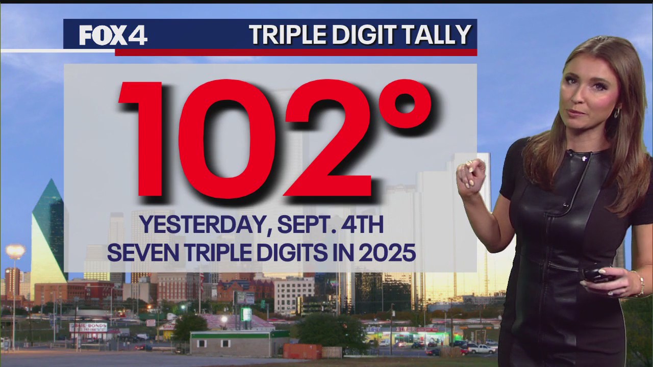
High temperatures will likely be in the low to mid-90s, with average highs typically around 92 degrees. Upper-level cloudiness may slightly dim the sun, preventing temperatures from reaching the triple digits.
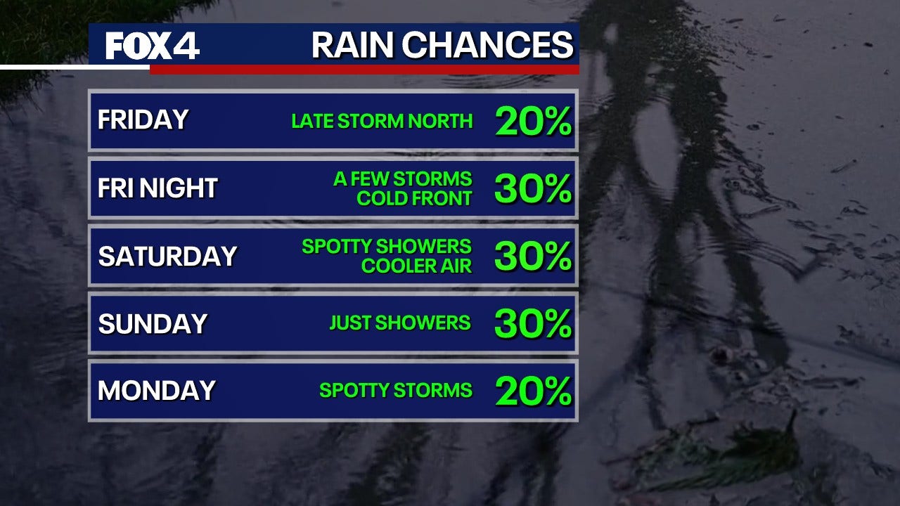
An upper-level disturbance is expected to move into North Texas this afternoon, with a 30% chance of storms. Some of these storms could produce strong winds, possibly reaching 50 to 60 mph, and small hail. The highest concentration of storms is expected north of DFW. Showers and storms will spread south overnight but are expected to be less severe.
Dallas-Fort Worth Radar  Weekend Outlook
Saturday morning will be cool and cloudy, with temperatures starting in the 60s to 70s. A few light storms are possible early, but showers will taper off for southern counties by the afternoon. Areas north of DFW will likely remain cloudy with some breaks in the late afternoon. High temperatures will climb into the low 80s, making it feel like fall.
The chance of showers on Sunday will be higher to the west and south of DFW, with a 40% or greater coverage. Areas to the north and east will have a lower chance, closer to 20%. Temperatures will begin in the 60s and rise to the low 80s under mostly cloudy skies.
7-Day Forecast 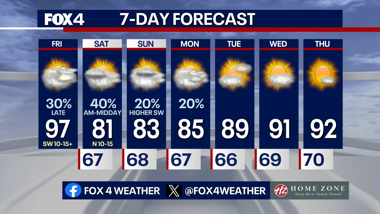
Temperatures will remain below average on Monday, with highs in the 80s and a slight chance of light showers. Highs will return to the 90s on Tuesday and remain there through the middle of next week as conditions dry out.
The Source: Information in this article comes from the National Weather Service and Meteorologist Evan Andrews.