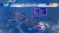
HONOLULU (Island News) — As of early Friday morning, Hurricane Kiko is located about 1,245 miles southeast of Hilo and around 1,450 miles southeast of Honolulu. The storm is moving slowly toward the west-northwest at about 9 miles per hour and is expected to continue in that direction over the next few days.
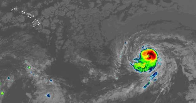
Kiko is currently a Category 3 hurricane with maximum sustained winds of 115 miles per hour. Some changes in strength are expected, and the storm is forecast to weaken by early next week as it gets closer to the Central Pacific region.
Even though Kiko is still far from the Hawaiian Islands, residents should pay attention to updates from the National Weather Service. There are no coastal watches or warnings in effect at this time, but the hurricane may begin to send swells toward the islands by the end of the weekend. These waves could create dangerous surf and rip currents along some shorelines.
It’s too early to say exactly how Kiko will affect the islands, but any impacts would likely begin late this weekend or early next week. Stay informed by checking official forecasts and surf advisories as conditions evolve.