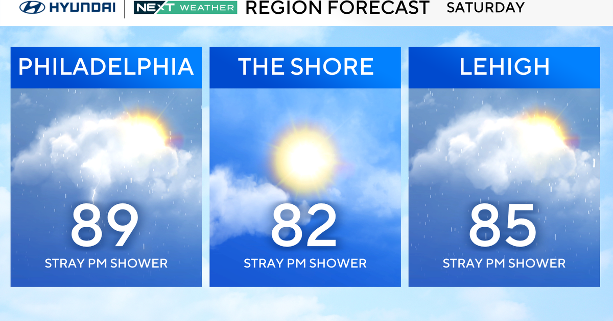
Saturday turns up the heat in a big way, with highs in the upper 80s and summer humidity making a comeback.
It’s definitely going to feel like a classic beach day, at least for a while.
The catch?
We’re under a marginal risk (Level 1/5) from the Storm Prediction Center, which means there’s potential for strong to severe thunderstorms later in the day.
The timing looks to be the evening, roughly 6 p.m. to 10 p.m., and storms could bring heavy rain, gusty winds and even some hail.

CBS Philadelphia
So if you’re making plans – whether it’s backyard barbecues or boardwalk rides in Wildwood or Ocean City – aim to do them earlier in the day and be ready to pivot indoors if those storms develop.

Sunday stays hot, with highs near 90, but it won’t feel quite as muggy. Whether you’re staying in the city or relaxing down the shore, it’s shaping up to be a solid day to soak up the sun.
The breeze off the water will help a bit at the beach, and overall, it looks like a quieter day weather-wise before the low 90s and storms return on Monday.
Fourth of July Forecast
Next week will be fairly similar day to day with heat, humidity and pop-up storms from time to time.
Looking ahead to Friday, your July 4th plans should be rain-free if models hold. Our NEXT Weather team will keep you posted.
Here’s your 7-day forecast:

CBS News Philadelphia
Saturday: P.M. thunderstorm. High 89, Low 68.
Sunday: Partly sunny. High 90, Low 73.
Monday: Back to the 90s. High 91, Low 72.
Tuesday: Thunderstorms are likely. High 88, Low 76.
Wednesday: Mostly sunny. High 89, Low 72.
Thursday: Mostly sunny. High 89, Low 71.
Friday: Mostly sunny. High 89, Low 69.
More from CBS News