DALLAS – The Dallas-Fort Worth metroplex is waking up to warmer temperatures this morning, with highs in the low 80s expected as morning clouds clear for a mostly sunny afternoon.
Sunday Forecast
Temperatures are starting the day in the upper 60s and low 70s, slightly warmer than Saturday morning due to lingering low clouds. The overcast skies will give way to partly sunny, and eventually mostly sunny, conditions later in the day. High temperatures are expected to reach the low 80s, which remains about 10 degrees below normal for early September.
The high temperature officially topped out at 79 degrees at DFW Airport on Saturday, but cloud cover kept overnight lows from dropping significantly.
Chance of Rain in Texas
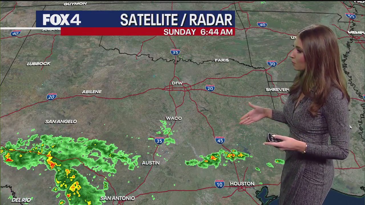
While North Texas has a less than 10% chance of isolated showers, other parts of the state are experiencing more significant weather. A few showers are ongoing south of Waco, and the bulk of the shower and thunderstorm activity is south of San Angelo, along Interstate 10 toward the Hill Country.
A flash flood warning was recently issued for areas north and west of San Antonio. Another complex of showers is moving along Interstate 45 toward the Houston area. These systems are the result of a disturbance and a stalled front to the south.
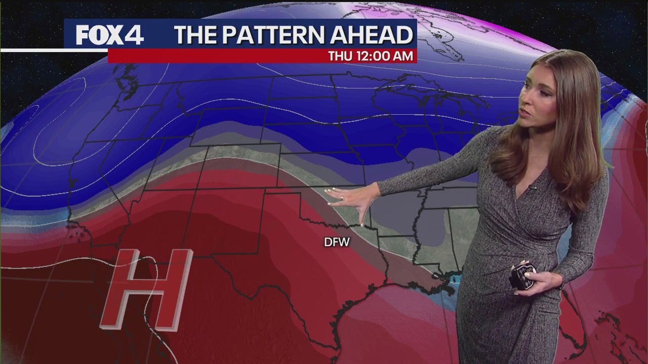
For the week ahead, high pressure will shift from northern Mexico to West Texas, bringing warmer and drier air. Temperatures are expected to remain in the 80s today, Monday, and Tuesday before climbing to around 90 degrees by Wednesday.
7-Day Forecast 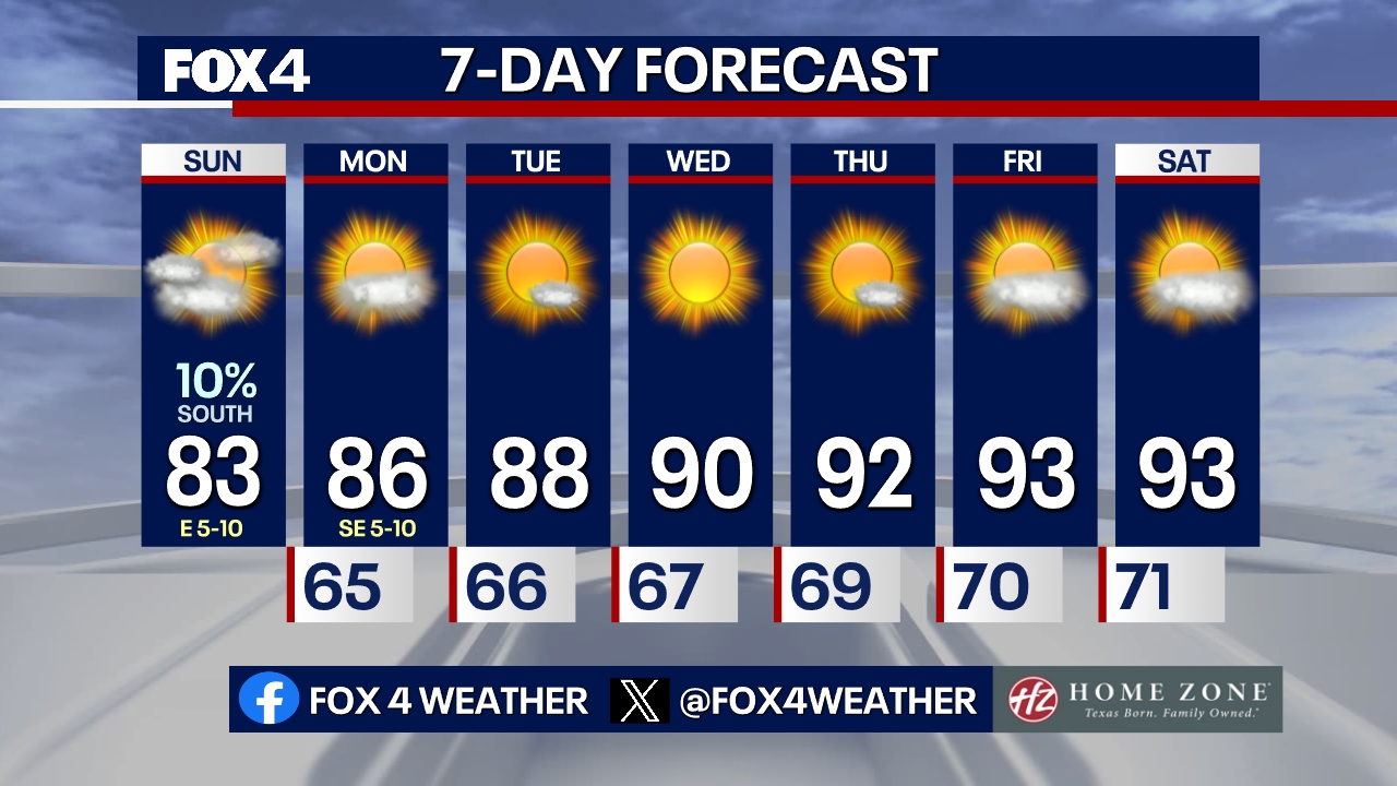 Tropical Forecast
In the Atlantic basin, the National Hurricane Center is forecasting no tropical development over the next seven days. A previously monitored area of disturbed weather has become extremely disorganized, dropping its chance of formation to zero percent.
The Source: Information in this article is from the FOX 4 Weather Team.