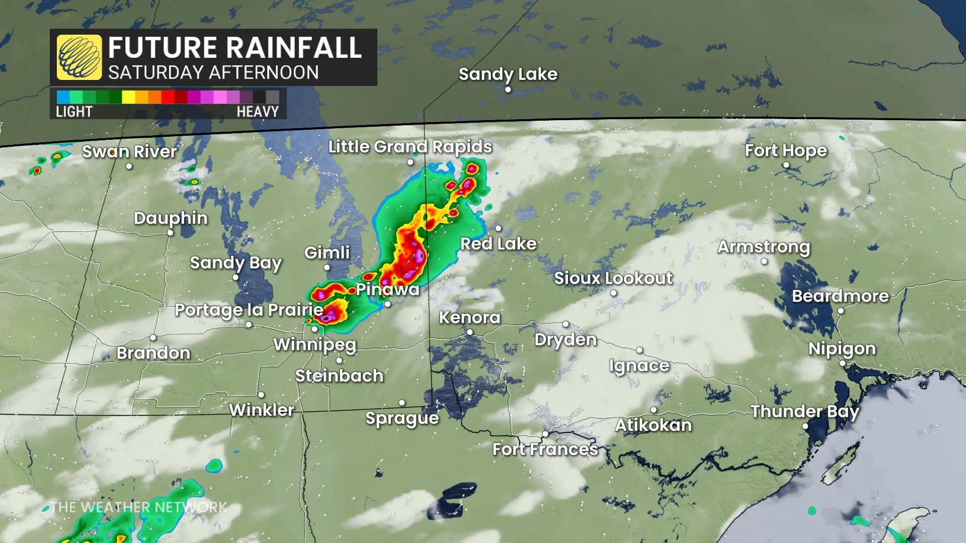
This risk includes Winnipeg, Brandon, and Dauphin in Manitoba, as well as Fort Frances, Dryden, and Kenora in northwestern Ontario.
Strong winds of 90-100 km/h, large hail up to the size of ping pong balls, and very heavy rainfall are possible in the most intense storms. Localized flooding may develop beneath any slow-moving cells.
Discrete supercells producing heavy rain and large hail are possible across southeastern Manitoba, including around the Winnipeg area, and into northwestern Ontario.
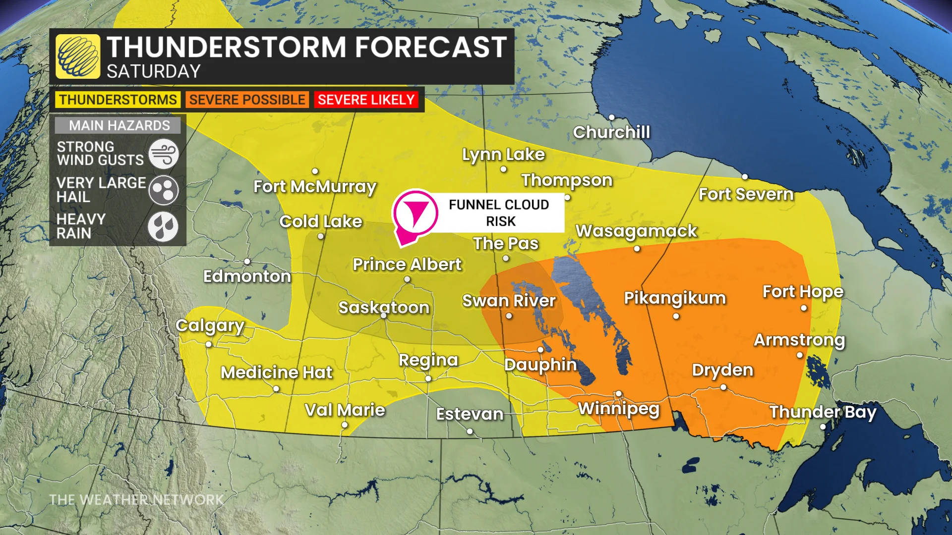
Farther west, there is also the risk of funnel clouds in parts of Alberta and Saskatchewan, as well as Manitoba, so stay weather-aware on Saturday. While not dangerous as funnel clouds, if they can do make contact with the ground, they can become landspout tornadoes.
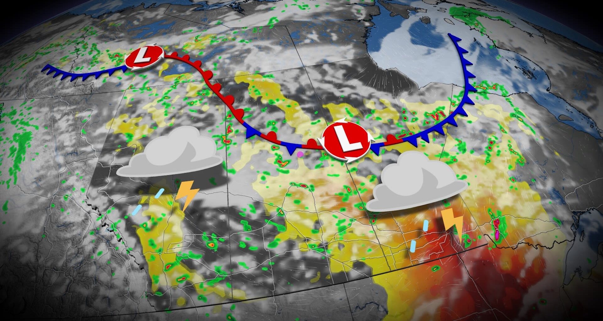
There is still uncertainty in terms of the timing of the storms, but they will most likely occur from 2 p.m. to 8 p.m. local time, stretching from the southern Lake Winnipeg area and continuing southeastward.
With this being an extended weekend, many folks will be travelling to celebrate the upcoming Canada Day holiday. So, it’s advised to stay weather-aware. Download The Weather Network app to received the most up-to-date information and weather alerts.