Good Tuesday, everyone! Changes are underway as unsettled weather takes over Tuesday and Wednesday, bringing clouds, showers, breezy conditions and cooler temps to the Philadelphia region.
All of this is because of an offshore low that’s currently churning off the coast of North Carolina. That storm will slowly drift to the north, altering our overall weather.

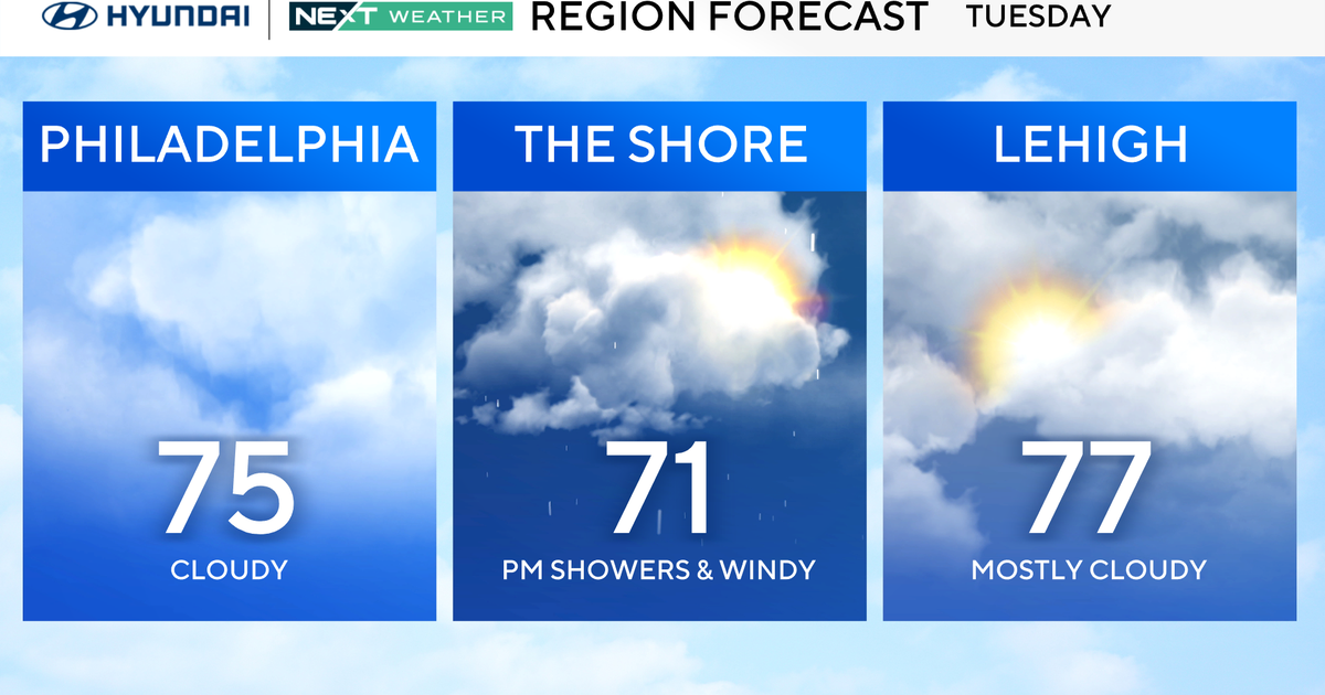
CBS News Philadelphia
Showers at the shore on Tuesday morning should diminish as they move inland, but we can’t rule out a spotty shower.
Wednesday looks like the more active day when clouds and periods of showers will affect the region, especially across southern Delaware and South Jersey, where rainfall could be heavier.

CBS News Philadelphia
Overall rainfall totals will range widely, from areas west picking up a tenth of an inch or so, while other parts of South Jersey may get 1 to 2 inches of rain. No flood alerts at this time, but your NEXT Weather team will continue to update any changes. Winds will also increase along the coast with gusts near 30 mph Tuesday into Wednesday.
By late Thursday, the system moves away, leading into a drier stretch. Temperatures surge into the mid-80s on Friday before a backdoor front knocks us back to the 70s over the weekend.
Here’s your 7-day forecast:

CBS News Philadelphia
Tuesday: Cloudy, P.M. shower. High 75, Low 63.
Wednesday: Showers. High 70, Low 64.
Thursday: A.M. clouds, P.M. sun. High 80, Low 65.
Friday: Mostly sunny. High 86, Low 63.
Saturday: Sunny skies. High 79, Low 63.
Sunday: Mostly sunny. High 76, Low 62.
Monday: Partly cloudy. High 81, Low 63.