PHOENIX (AZFamily) — We have issued First Alert Weather Days Sunday through Tuesday due to the extreme heat.
The National Weather Service has issued an Extreme Heat Warning for those days, which means popular trails like Camelback, Piestewa, and some at South Mountain will be closed.
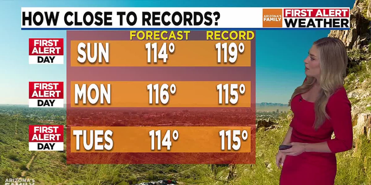
Monday looks to be the hottest day, with a high of 116 degrees, which, if we reach that high, would break the record high temperature of 115 set back in 2013. There is a major heat risk on Monday, meaning this heat will impact anyone, regardless of age or health, if you are outside for extended periods with no way to cool off or stay hydrated.
Temperatures will be around 114 on Tuesday, then a significant cool down is expected, with temperatures actually dropping below the average of 107 for this time of year, all thanks to an increase in moisture. This could also bring a slight chance for showers and thunderstorms for portions of Arizona, with most of the activity favored across the high country.
Models are showing the Pacific low bringing some shower chances into the state as early as Tuesday afternoon, with better chances on Wednesday, mainly for the higher terrain. There’s about a 20% of showers across the Valley on Thursday and Friday.
The good news is temperatures will really come down. We’re looking at high temperatures around 102-103from Thursday to Saturday.
See a spelling or grammatical error in our story? Please click here to report it.
Do you have a photo or video of a breaking news story? Send it to us here with a brief description.
Copyright 2025 KTVK/KPHO. All rights reserved.