Published on Jun. 29, 2025, 12:55 AM
Stay aware of rapidly changing conditions and have a safe place to go if you’re outdoors when storms approach your area
Folks across Ontario should have alternate plans for their long holiday weekend as a renewed threat for strong to severe thunderstorms bubbles up across the region.
We’ll see the potential for storms build on Monday as favourable dynamics sweep into the region. Stay aware of the forecast for your area, and as always, have a way to receive severe weather watches and warnings the moment they’re issued.
DON’T MISS: What is a mesoscale convective system? How an ‘MCS’ can spell danger
Severe storm risk arrives on Monday
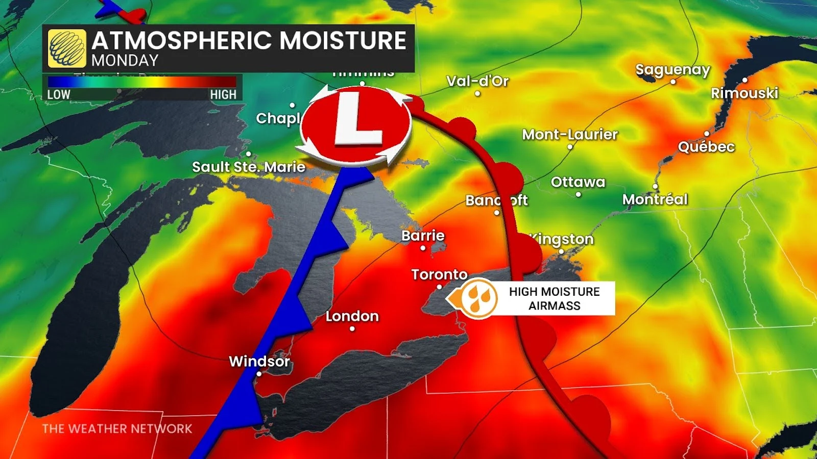
Soak up Sunday’s pleasant weather across southern Ontario while it lasts. Monday will see a warm front lift across the region, dragging a humid airmass north of the border.

Elevated moisture, daytime heating, and an approaching cold front will spark and fuel a risk for thunderstorms across most of southern Ontario, stretching into northeastern sections of the province. This includes the Greater Toronto Area.
Dynamics are most favourable for severe thunderstorms from Windsor north through Sudbury, including London, Barrie, and Parry Sound.
Forecasters expect clusters of thunderstorms to develop along the cold front, bringing the potential for very strong wind gusts. Large hail is possible across cottage country into northeastern Ontario.
