PHOENIX (AZFamily) — An Extreme Heat Warning starts at 10 a.m. today and continues until Tuesday evening. That’s why today, Monday, and Tuesday are all First Alert days.
If possible, try to do outdoor activities early in the morning or in the evening.
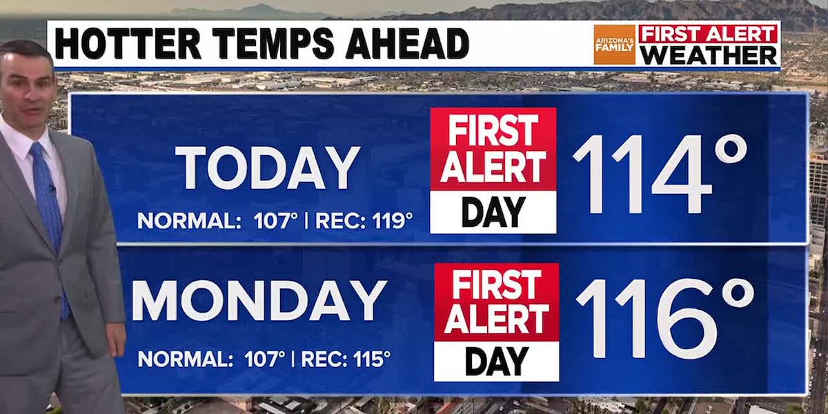
A high of 114 is forecast today, followed by a high temperature of 116 forecast for Monday. The record high temperature for Monday is 115 degrees. Tuesday will also be well above normal with a high near 114.
There will be a slight chance of showers and thunderstorms late Tuesday and Wednesday, but most of the activity is expected to remain in the higher elevations. A slightly better chance (about 20%) of showers and thunderstorms moves into the Valley on Thursday, followed by a slight chance of a shower or thunderstorm on the 4th.
Another big part of the weather story will be the dropping temperatures. Highs will decrease to around 108 by Wednesday, but they will likely drop below normal for a few days, with highs of 103 on Thursday and 104 on Friday, the 4th. Highs could stay just around or below normal on Saturday before gradually rising for the rest of the holiday weekend.
See a spelling or grammatical error in our story? Please click here to report it.
Do you have a photo or video of a breaking news story? Send it to us here with a brief description.
Copyright 2025 KTVK/KPHO. All rights reserved.