The forecast today in western North Carolina will see increasing clouds from east to west.
A few spotty showers are possible today. Scattered showers are possible tonight and Tuesday, along with isolated thunderstorms. This is moisture streaming northward from Imelda.

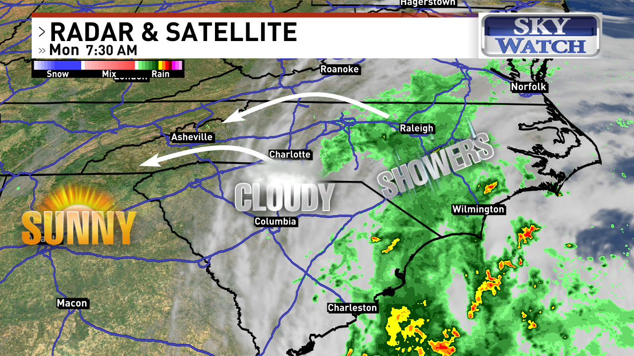
Radar and satellite as of 7:30 a.m. on Monday, Sept. 29. (WLOS)
Tropical update:
Good riddance, Imelda! Thanks to the Fujiwhara Effect, Humberto will be pulling Imelda out to sea over the next several days. They are only about 635 miles apart this morning.
Heavy rain showers, dangerous surf and rip currents are likely from the beaches of east Florida all the way up into the Mid-Atlantic states.
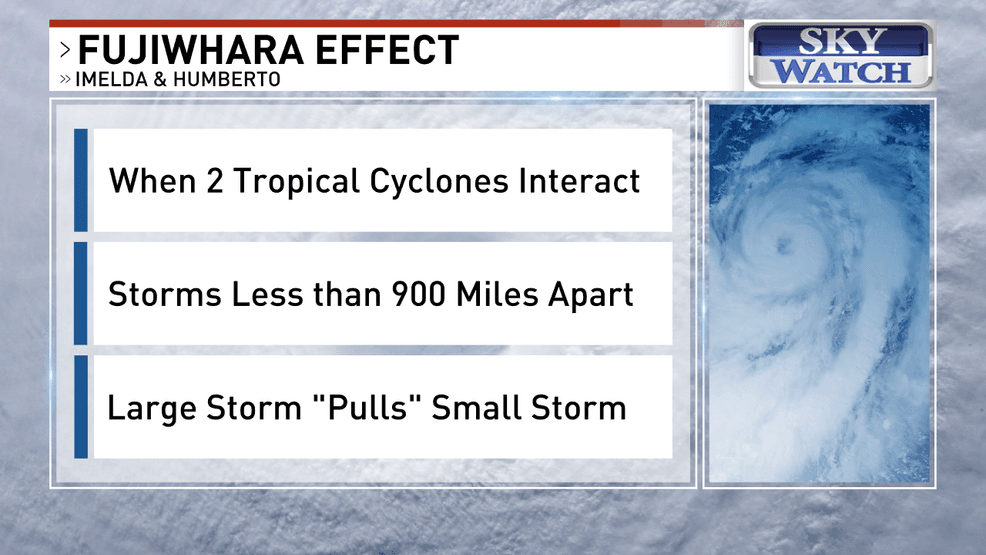
Explaining the{ }Fujiwhara Effect. (WLOS)
Impacts here in western North Carolina will be minimal. Clouds increase, and we’ll see some spotty showers today into tonight. A few showers and thunderstorms are possible on Tuesday before the storm pulls away.
Gusty winds are likely in the Foothills and Upstate.