 Houston weather: Hazy, sunny Monday to start the week
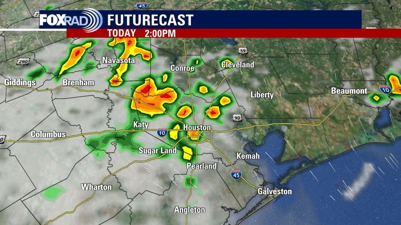
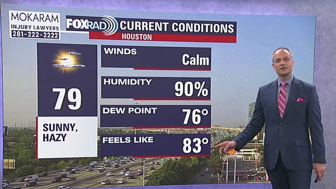
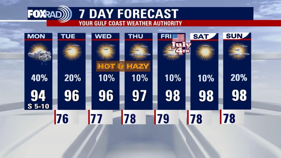
The morning is starting off quiet before it turns into a typical summer day feeling hot and humid. Overall, the conditions for rain don’t look as strong as yesterday, but scattered afternoon storms are a safe bet. Highs will be in the 90s with a heat index slightly above 100 by noon.
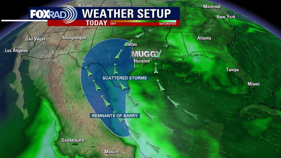
HOUSTON – We still have an “uncapped” atmosphere on Monday along with plenty of gulf moisture. Overall, the conditions for rain don’t look as strong as yesterday, but I still think scattered afternoon storms are a safe bet.
Otherwise, expect a hot, typical early summer day with highs in the low to mid 90s and a heat index slightly above 100 by noon. You may start to notice some increasing haze in the sky, but air quality is expected to be moderate.
Hazy, hot and humid
Isolated storms will be possible again on Tuesday, but as the week continues, our temperatures will rise as rain chances fall. Daily highs will range from about 94-99 across inland areas for the rest of the week with the beaches topping out in the low 90s.
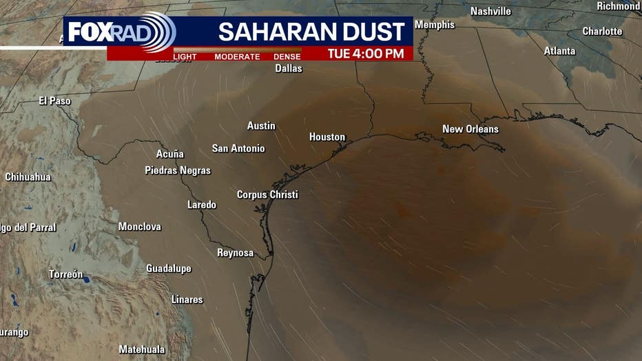
Saharan dust could make the skies look a bit hazy, especially on Tuesday and Wednesday. Heat index values could reach 105 most afternoons.
Update on the tropics
A small system named Tropical Storm Barry formed over the weekend in the southern gulf and made landfall as a tropical depression in Mexico, well south of Texas. Residual moisture from the storm could lead to rain in South Texas and even have a slight effect on our rain locally today.
Otherwise, a storm named Flossie will move along Mexico’s Pacific coast and probably become a hurricane today or tomorrow – no effect on Texas.
Florida is looking at rounds of thunderstorms from an area of low pressure that has a slight chance of development late this week.
The Source: Information in this article is from the FOX 26 Houston weather team.