
HOUSTON – It’s another warm day for us on Monday as things will heat up in the afternoon to the low 90s. There could be a bit of relief with some isolated showers possible.
More warm temperatures, watching increase in moisture 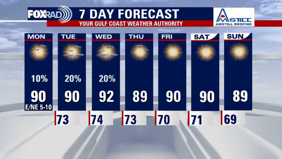
Today will be another above average day with highs in the low 90s and upper 80s for southeast Texas. Prepare for temperatures to remain warm for October for all your outdoor plans this week.
Rain chances are slim. Look for a few showers this afternoon. Isolated chances for rain stay in the forecast for Tuesday and Wednesday.
Dry conditions leading to minor drought 
Drought conditions are developing state and areawide, communities west of Houston are finding themselves in moderate drought conditions. Houston proper is not yet in a drought, but it is dry. Dry vegetation is leading to an increased risk for brushfires, so be very cautious with any outdoor burning until conditions change. Lower humidity values also lead to an increase in fire danger.
In the tropics
The National Hurricane Center continues to monitor a disturbance in the distant Atlantic.
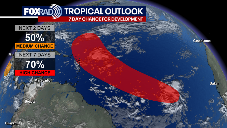
As of the recent update at 8 a.m. EDT this area has a 70% HIGH chance of development the next seven days. There will likely be a depression or tropical storm forming this week. This formation is thousands of miles away and the long-term path is uncertain. The next name on the list is Jerry.
The Source: Your Gulf Coast Weather Authority.