NEW YORK CITY – The threat of a coastal storm this weekend in the New York City area is beginning to take shape, with the possibility of heavy rain, high winds and coastal flooding for the region.
JUMP TO: TIMELINE l IMPACTS l LIVE UPDATES l RADAR
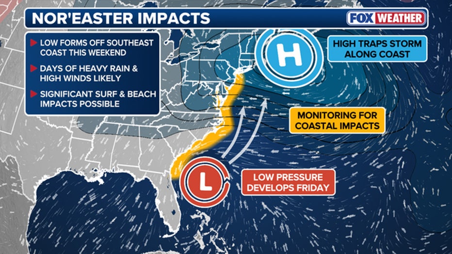
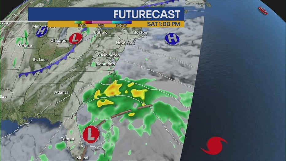
An overview of the forecast for a possible nor’easter this weekend. (FOX Weather)
“Coastal storm, nor’easter, which is coming into the Tri-State with a good amount of wind and rain, perhaps some beach erosion,” FOX 5 NY’s Mike Woods said.
What is a nor’easter?
What we know:
The storm will likely be of the nor’easter variety, meaning it will pack strong winds that blow from the northeast and heavy precipitation. While the term nor’easter conjures images of winter weather, cold air will not be in place during this storm, meaning all the precipitation will be of the liquid variety along the Interstate 95 corridor.
Timeline:
Here’s a look at the weekend weather in New York City, according to the National Weather Service (NWS).
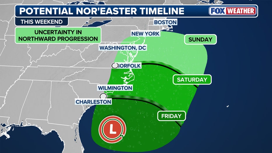
This graphic shows the timeline for this weekend’s nor’easter, beginning on Oct. 10, 2025. (FOX Weather)
- Saturday: Partly sunny, with a high near 65. Northeast wind 6 to 11 mph becoming southeast in the afternoon.
- Saturday night: A 50% chance of rain. Mostly cloudy, with a low around 58.
- Sunday: Rain likely, mainly after 2 p.m. Mostly cloudy, with a high near 60. Breezy. The chance of precipitation is 60%.
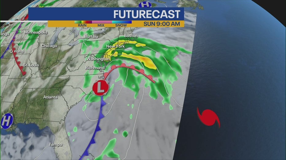
- Sunday night: Rain likely. Mostly cloudy, with a low around 57. Windy. The chance of precipitation is 70%.
- Monday: Rain likely, mainly before 2 p.m. Mostly cloudy, with a high near 60. Breezy. The chance of precipitation is 60%.
“Rain chances pick up Sunday into Monday, and even Tuesday too,” Woods said.
Local perspective:
Days of heavy rain, high winds, dangerous rip currents and high surf are likely if the storm develops as expected. NOAA’s Weather Prediction Center issued a Level 2 out of 4 flash flood risk for parts of the New York City area on Sunday.
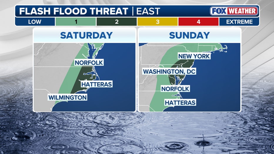
This graphic shows the flash flood threat beginning on Saturday, Oct. 11, 2025. (FOX Weather)
“High surf is expected on many East Coast beaches, which will generate strong rip currents and potentially lead to some beach erosion,” the NWS Weather Prediction Service said.
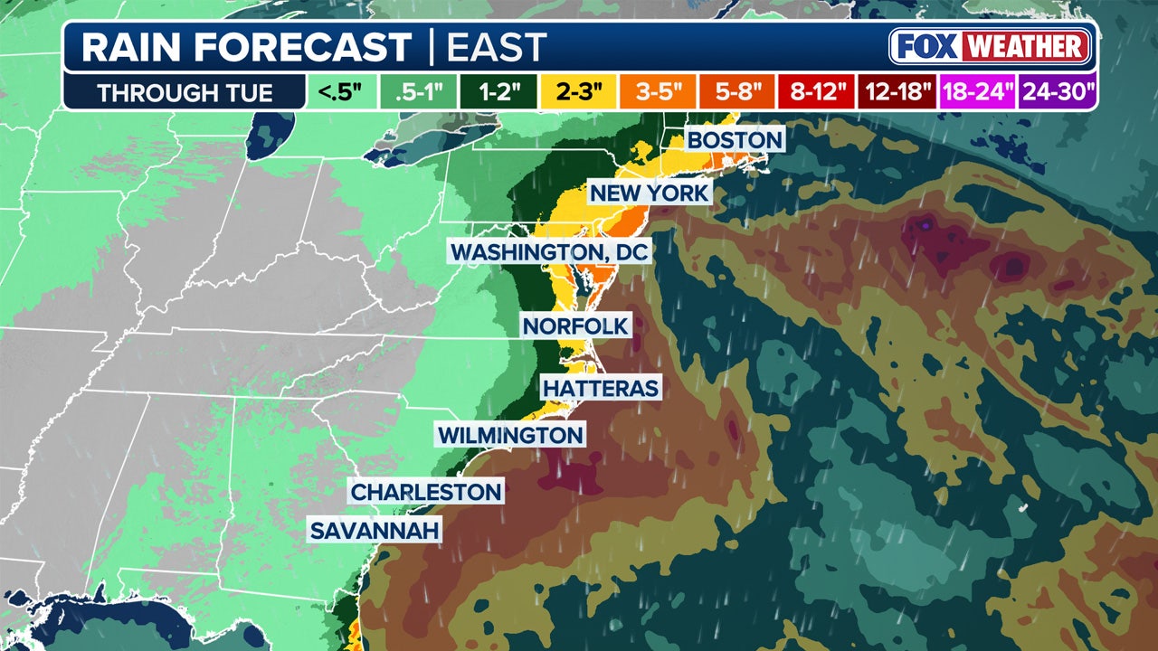
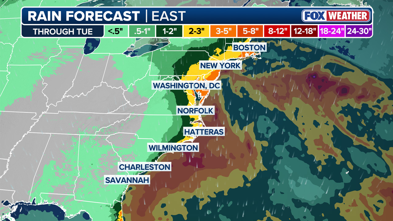
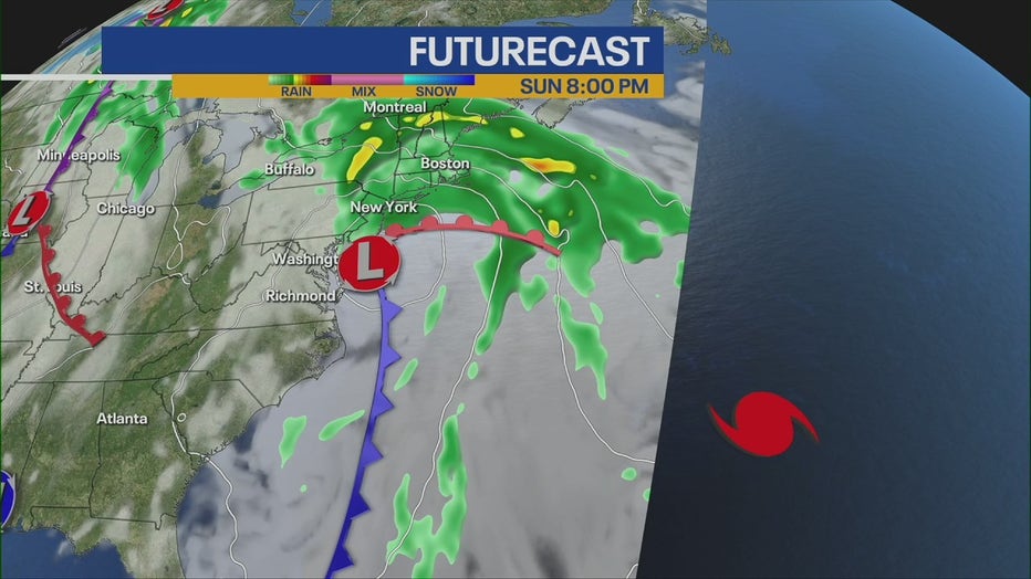
According to the FOX Forecast Center, rain closer to the coast looks to amount to a widespread 2-3 inches through Monday. Localized amounts closer to 3-5 inches are possible, with wind gusts of 30-50 mph possible along the Northeast coast through Sunday and into early Monday.

This graphic shows the potential rainfall from this weekend’s nor’easter. (FOX Weather)
“The storm is likely to bring wind guests in excess of 45 mph and periods of heavy rain, primarily to areas near the coast,” the NWS said. “This may bring additional flooding from the rainfall outside of the immediate coastal zone, as well as the potential for scattered power outages.”
Nor’easter East Coast impacts
Big picture view:
Parts of the Chesapeake Bay and the Virginia and Maryland coasts are also under a flood threat. Anywhere from the Carolinas to southern New England is at risk of being impacted.
What they’re saying:
“Potentially significantly impacts appear increasing likely for our coastal areas Sunday through Monday. Moderate to major coastal flooding, strong to damaging winds, beach erosion, and very dangerous marine conditions are possible,” NWS Mount Holly said in a post on X.
What we don’t know:
How far north the area of low pressure will make it up the coast still remains something of an open question.
Click HERE for more information.