Saturday will be mostly cloudy with scattered showers and a high of 71. But, It’s time to make your backup plans if you had anything outdoors set for Sunday as a strong area of low pressure (a coastal low) will be developing south of our area and moving north.
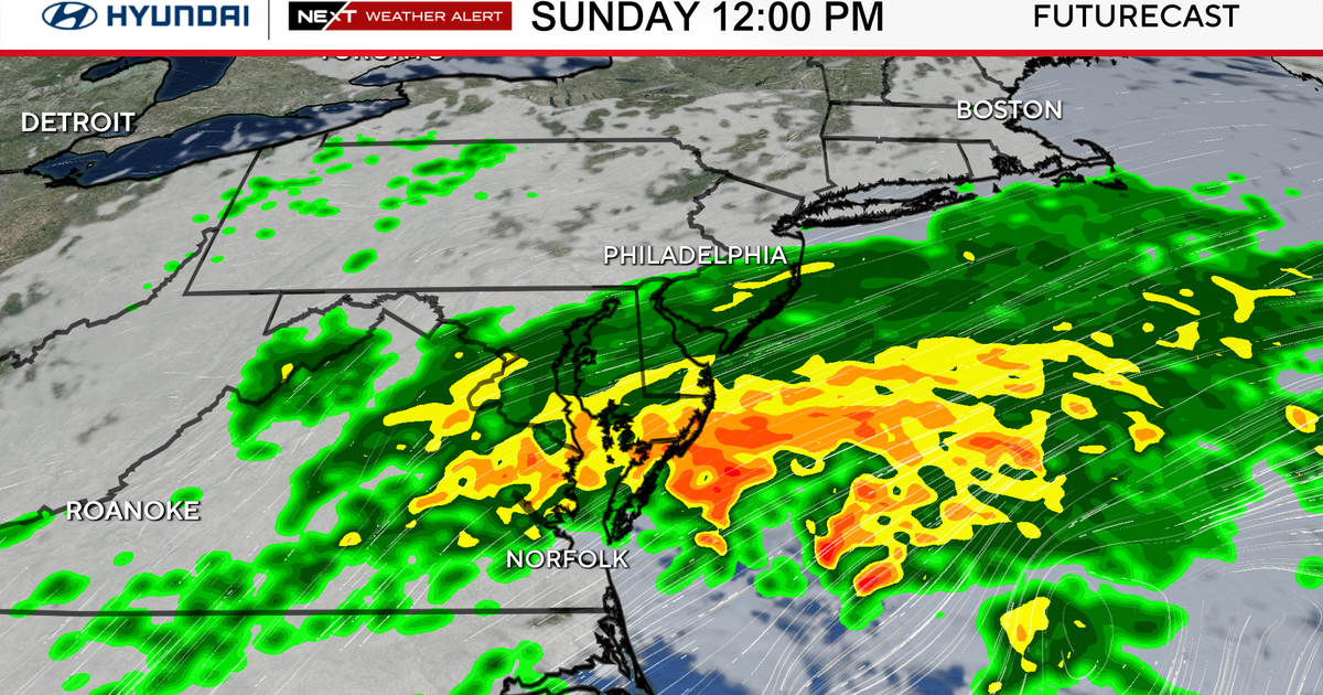
Sunday’s coastal storm is predicted to touch most, if not all, of the Delaware Valley.

CBS News Philadelphia
Impacts will be widespread but felt the greatest along the shore where high winds to 60mph along with up to 3″ of rain will fall by Sunday afternoon. In addition, seas will be extremely rough with waves potentially 15-20′ in spots so flooding is likely, especially around high tide.

CBS News Philadelphia
Closer to the I-95 corridor, winds to 40mph along with upwards of 1″ of rain will be likely so power outages are a possibility as well as very slow travel Sunday and Monday. Your morning commute Monday could be very slow.

CBS News Philadelphia
With all that said, it’s worth noting that the forecast models, even just 2 days out, are still in disagreement as to where the low pressure system will eventually end up. This may have decent impact differences if it’s much farther east vs. much farther west.
It’s important that you stay weather aware and updated as this system approaches, especially for our shore locations.
By Tuesday the system moves east and rather quiet weather settles in with a slight warmup by midweek.
Here’s your 7-day forecast:

CBS News Philadelphia
Saturday: Clouds, p.m. shower. High 72, Low 53
Sunday: NEXT Weather Alert for rain and wind. High 66, Low 63.
Monday: NEXT Weather Alert for rain and wind. High 62. Low 58.
Tuesday: Some sun. High 67, Low 56.
Wednesday: Partly cloudy. High 73, Low of 55.
Thursday: Partly cloudy. High 64, Low 48.
Friday: Mostly sunny. High 69, Low 51.