A strong cold front is moving through the Philadelphia area tonight, bringing a line of showers and a few thunderstorms between now (to the west) and 3 a.m. The line will be fast-moving but could produce brief gusty winds. The atmosphere is not very unstable, but it is strongly sheared, which means a few stronger wind gusts could mix down to the surface.
Lightning will be limited given the shallow, low-topped nature of the storms.

CBS News Philadelphia
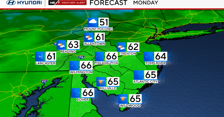
Behind the front, rain quickly tapers toward the morning, but some wraparound showers could linger into Monday, especially north and west. Winds will shift sharply to the west-northwest and increase through the day, with gusts reaching 25 to 35 mph. Temperatures will be about 10 to 15 degrees cooler than Sunday, keeping highs in the 50s and low 60s.
High pressure briefly returns Monday night before another front moves through late Tuesday with a few scattered showers. Winds will pick up again midweek, especially Wednesday, when another surge of colder air arrives. The rest of the week trends cooler and breezy, with high pressure settling in and drier weather by Friday.
Here’s your 7-day forecast:

CBS News Philadelphia
Monday: Windy and cooler. High 66, Low 56.
Tuesday: Sunny. High 73, Low 46.
Wednesday: Morning shower? Sunny. High 65, Low of 53.
Thursday: Partly cloudy. High 63, Low 47.
Friday: Sunny. High 62, Low 44.
Saturday: Partly cloudy. High 63, Low 43.
Sunday: Partly cloudy. High 63, Low 48.