Summer-like temperatures shattered heat records in Phoenix last October. This year? The hot weather retreated and a series of tropical storms drenched the area.
October 2025 was a sharp contrast from the relentless, record-setting heat of 2024. This year’s temperatures hovered close to the monthly average, with more clouds, cooler afternoons and a series of storms that pushed October’s rain total to the third-wettest on record.
“It was much cooler,” said Gabriel Lojero, a meteorologist with the National Weather Service in Phoenix. “But last year was the warmest October on record across the area.”
Here’s a comparison of the two months, drastically different but only one year apart:
October 2024: Record-shattering heat and no rain
Phoenix’s October 2024 will go down as one of the most extreme months in the city’s weather history.
The month started with a streak of triple-digit days, even reaching into the 110s. Phoenix hit 113 degrees on both Oct. 1 and Oct. 6, and stayed in the triple digits for the first half of the month. The city broke or tied a daily record high on 21 consecutive days from Sept. 24 through Oct. 14.
Before 2024, America’s hottest big city had never reached 110 degrees in October. That month, it happened four times.
But why was it so hot? An “anomalously strong” high-pressure system parked itself over the desert Southwest, according to Lojero. It trapped heat below and banished any cloud cover, allowing temperatures to soar and preventing any rain.
The month ended with an average high temperature of 97.9 degrees, about nine degrees above normal, and an average temperature of 84.5 degrees, making it the hottest October on record. Lows were also unusually warm, averaging 71.1 degrees.
The weather station at Phoenix Sky Harbor International Airport recorded only trace amounts of rain all of that month, compared with the normal 0.56 of an inch, ranking it among the driest Octobers on record.
October 2025: Cooler, cloudier and much wetter
Just a year later, the pattern flipped.
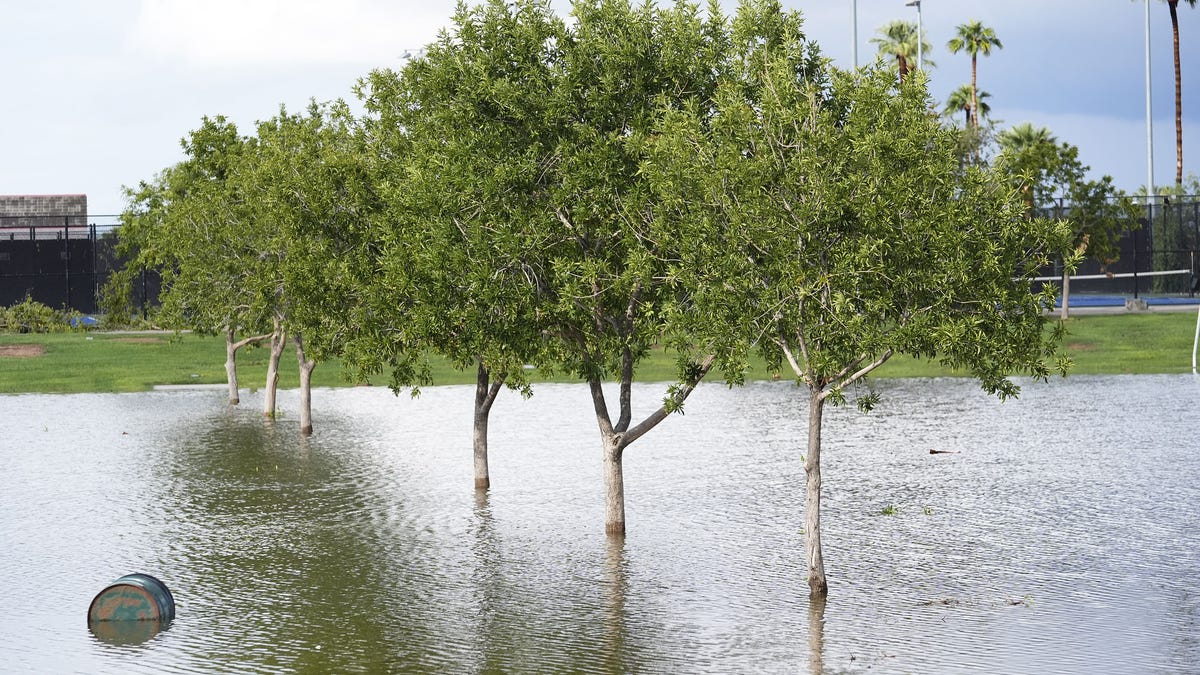
October 2025 brought a series of moisture surges from the Pacific, notably the remnants of Tropical Storms Raymond and Priscilla, that fueled days of widespread rain across Phoenix. From Oct. 9 to Oct. 13, the airport logged more than 3 inches of rain, with nearly 2 inches on Oct. 12.
By the end of the month, the weather station tallied 3.26 inches of rain, nearly five times the normal amount and the third-wettest October on record, behind 2018’s 5.35 inches.
Temperatures were much closer to normal. The average high was 89.5 degrees, just 0.3 degrees above normal, and the mean temperature was 78.3 degrees, just 0.9 degrees above normal. The city saw only three days of triple-digit heat, topping out at 102 degrees, a far cry from last year’s 110s.
“The difference this year was that we had more moisture and more cloud cover, which kept daytime highs cooler,” Lojero said. “It definitely was a much cooler October compared to last October.”
A warming trend beneath the cooldown
Even though this October felt refreshingly normal, the long-term trend tells a different story. Fall in Phoenix and much of the Southwest is getting warmer.
Average fall temperatures in Arizona counties have increased by 3 to 4 degrees since 1970, according to Climate Central. September and October have felt like an extension of summer in recent years, with hotter days, warmer nights and little relief until November.
Maricopa County has warmed by an average of 4.2 degrees in the fall since 1970. In Phoenix specifically, average fall temperatures have become 5.7 degrees warmer.
When will it finally cool down more?
Looking ahead, Phoenix’s fall cooldown is still a work in progress. Lojero expects temperatures to stay slightly above normal through early November, with afternoon highs in the upper 80s.
“Through the middle of next week, we’ll continue with warmer-than-normal temperatures and dry conditions,” he said. “By the middle of the month, we may turn cooler with a potential increase in rainfall chances, but we’ll have a better idea as we get closer.”
Normal November highs fall into the mid-70s, so a more sustained cooldown may not be far away, even if it still feels like summer is lingering in Phoenix.
Hayleigh Evans writes about extreme weather and related topics for The Arizona Republic and azcentral.com. Email her with story tips at hayleigh.evans@arizonarepublic.com.