JACKSONVILLE, Fla. – Areas of patchy fog this morning with warm days ahead of two cold fronts. The first one won’t impact our area beyond cloudy skies, which will remain dry. Skies will feature a mix of sun and clouds with more sunshine inland, especially across Georgia, and a few more clouds over Northeast Florida.
Highs in the upper 70s, lower 80s inland.
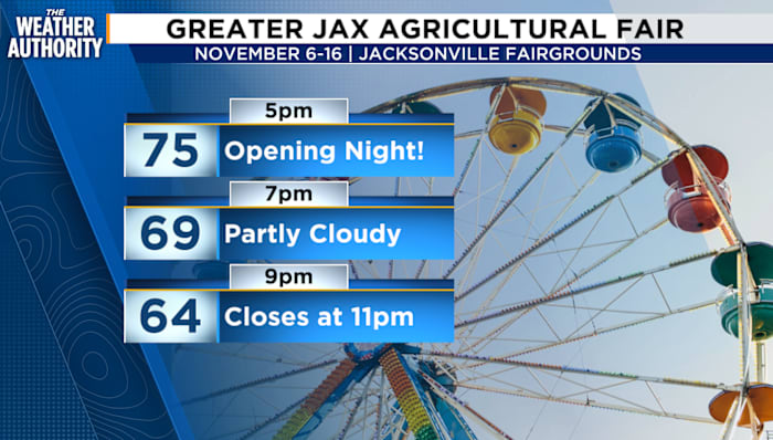
Pack a light jacket for the opening of the Greater Jacksonville Agricultural Fair! Tonight’s forecast is fantastic for a fall fair atmosphere. Gates open at 5 p.m. with temperatures in the mid-70s. After sunset at 5:35 p.m., the temperatures will drop into the upper 60s.
Thursday PM
This weekend will be nice and warm, with the next chance for rain coming Saturday into Saturday night and Sunday.
The second front will pack a winter punch. A stronger cold front sweeps through on Sunday, bringing a few isolated showers or thunderstorms. Winds will turn gusty from the southwest before shifting northwest behind the front.
Once it passes, get ready for a winter-like cooldown! By Monday and Tuesday, highs will only reach the 50s to near 60, about 25 degrees colder than Sunday.
Lows will tumble into the 40s Sunday night, then upper 20s to mid-30s by Monday night, meaning widespread frost and a likely inland freeze. Coastal spots will stay a little milder.
Lows Tuesday morning could bottom out around 33 degrees, which is close to being the first freeze of fall. The average freeze date is December 12.
Copyright 2025 by WJXT News4JAX – All rights reserved.