SAN ANTONIO – At this time, much of the area is dry with just hit or miss showers in our region along with breaks of sun making for a hot and very humid day. However, that will be changing for parts of our viewing area as showers and storms develop and a risk for flash flooding will be in our region.
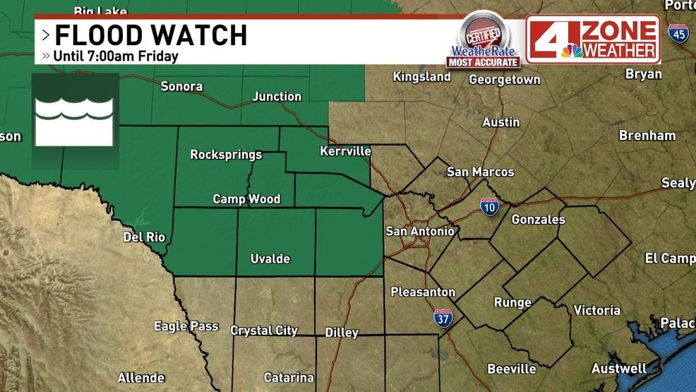
The National Weather Service issued a Flood Watch for this risk that will expire Friday morning around sunrise. This watch does not include Bexar County but is very close. Along the Hwy 90 corridor to the west and north will be fair game for pockets of very heavy rain.
The setup for all of this activity, tropically humid air holding a lot of water remains locked in place across our region. This supports extremely high rainfall rates in any storm we see. Another big piece to this puzzle, a Mesoscale Convective Vortex (MCV) or energy aloft is way out west and moving to the east-northeast.
Strongest lift from a feature like this is the northeast, east to south quadrant. It should drift just north of our area putting areas in the Flood Watch on the southern flank of this feature which would develop slow moving storms that would potentially train over the same area.
A scenario like this could easily produce isolated rainfall amounts well over 5″ of rain. Latest modeling trends suggest a bullseye target from northern Medina, Bandera, eastern Real to southern Kerr County in the heart of the Flood Watch. As for Bexar County, parts of the county could see well in excess of 1″ – 2″ of rainfall from heavy downpours while other parts of the county may only see a .25″ or more of rain.
4th of July Friday, patchy showers in the morning that linger into some of the afternoon. We should see a gradual decrease in the rain chance into the evening. I will carry a 20% rain chance through 7pm then lower to 10% or less through 9pm.
Here are a series of future radar images that outline expectations above in this article.