Accumulating lake effect snow now looks more likely near lake Michigan Sunday night into Monday morning, which could pose a problem for Monday morning commuters in Chicago and northwest Indiana.
The first round of wet snowflakes is expected to fall late Saturday night into Sunday morning. With the flakes following closely on the heels of soaking rainfall and with relatively warm temperatures near freezing, no roadway impacts are expected. A dusting on grassy surfaces is possible.
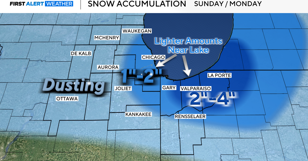
But as temperatures plummet to Chicago’s first hard freeze of the season – into the 20s areawide Sunday night – a second round of snow may be more efficient at accumulating and lead to Monday morning traffic headaches.

The second round of snow Sunday night into Monday will be lake effect snow, created by near record cold upper level air (-11 degrees Fahrenheit at 10,000 feet) blowing over near record warm Lake Michigan water temperatures, still in the 50s. As warm, moist air from the lake rises, it leads to deep, convective clouds that are efficient snowflake producers. This combination can lead to localized bands of heavy snow. Small changes in wind direction, however, can have huge impacts on the placement of these lake effect snow bands.
As of now, heavy bands of lake effect snow are most likely in northwest Indiana, where 2-4 inches are forecast with locally higher totals away from the lake. If the wind shifts and the band of snow swings into Chicago overnight, which is possible, 1-2 inches of snow could fall in the city with locally higher totals. Roads will be slick Monday morning wherever the snow bands set up.
Stay with CBS News Chicago for forecast updates through the weekend on this first snow event of the season.