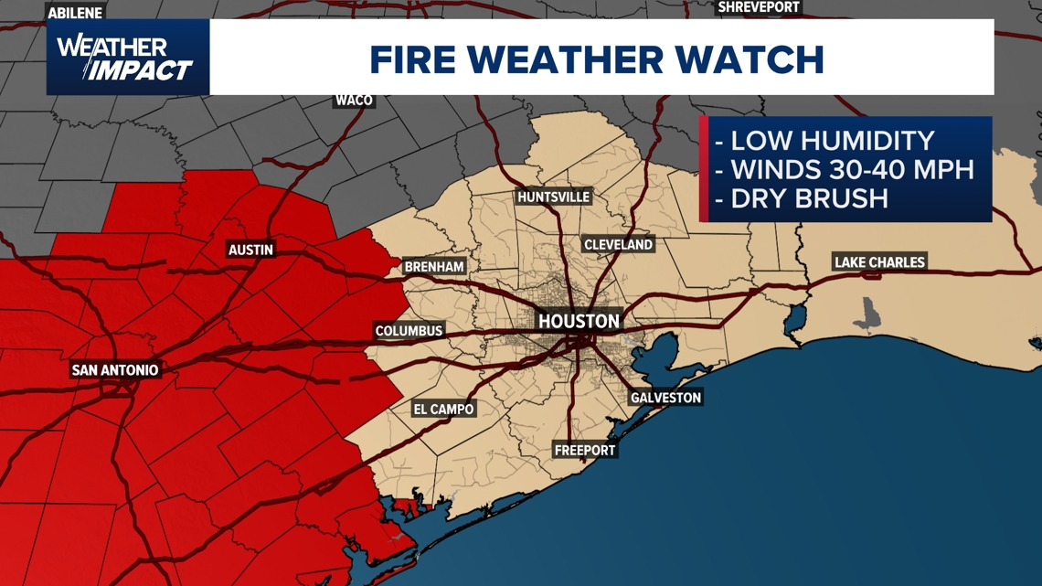
A Fire Weather Watch is in effect for the entire Houston area.
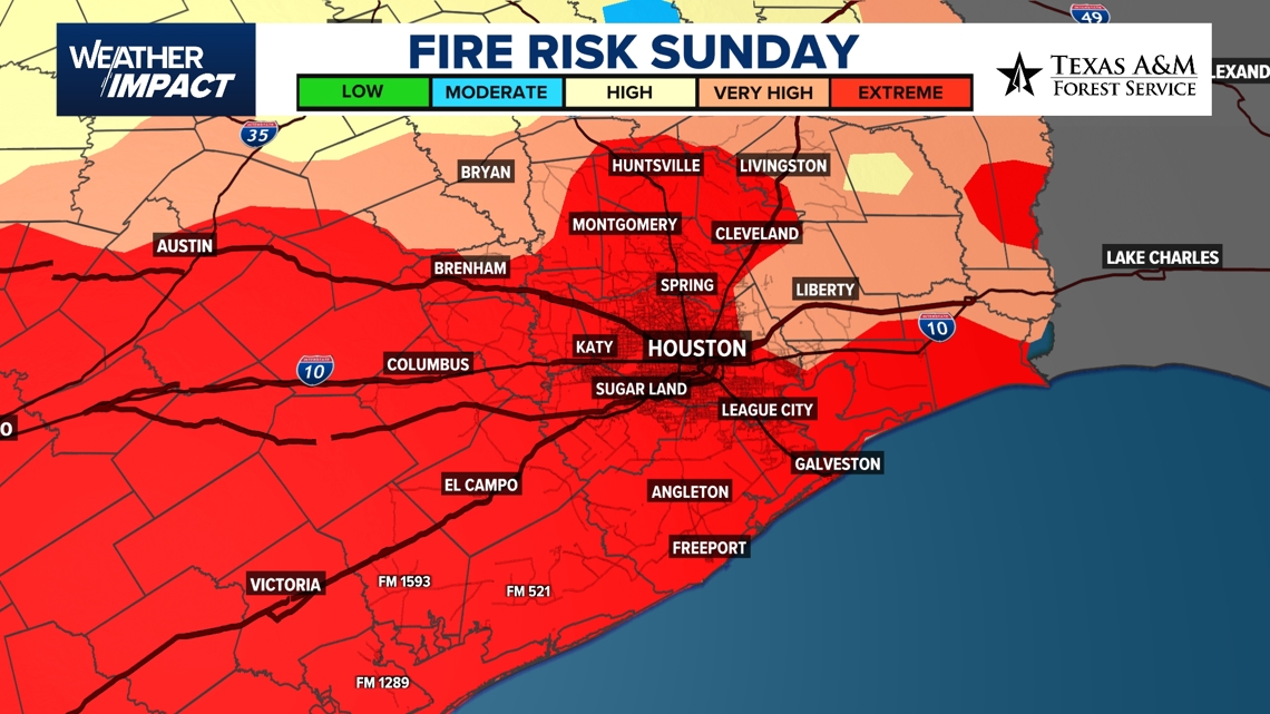
HOUSTON — A strong cold front moving into the Houston area Sunday will bring much cooler temperatures, but it’s also creating a high fire danger across Southeast Texas.
Meteorologist Pat Cavlin said the setup for Sunday includes gusty winds, dry air, and parched brush, which is a combination that makes it easy for any fire to spread quickly.
“The first thing that we’re going to be focusing on are the whipping winds for tomorrow, and that’s going to set us up with this fire danger,” Cavlin said. “It’s these winds that will bring in that cold weather as we get into the start of the week.”
Gusts could reach 25 to 35 miles per hour Sunday afternoon, and humidity levels are expected to drop to some of the lowest levels since last winter. That, Cavlin said, is part of what makes this setup so concerning.
“I’ve never seen this in my almost 4 years here in Houston,” he said during his Sunday night forecast on KHOU 11. “An extreme category for fire danger for pretty much the entirety of Southeast Texas.”
A Fire Weather Watch is in effect for the entire region. Officials urge residents to avoid outdoor burning, secure anything that could blow away, and use caution with tools or vehicles that could spark a fire.

Got a news tip or story idea? Email us at newstips@khou.com or call 713-521-4310 and include your name and the best way to reach you.