SAN ANTONIO – San Antonio’s Transportation Department is hosting four planned community open house meetings beginning this week, inviting the public to provide feedback on pedestrian safety around the forthcoming Green Line project.
The meetings, which begin Wednesday evening, will explore walkability improvements and pedestrian safety enhancements along the transit corridor, according to an SASpeakUp meetings page.
Open House #1: Steves Avenue Transit Station
-
5-6 p.m. on Wednesday, Nov. 12, at the Roosevelt Park Clubhouse
Open House #2: Olmost Park Transit Station
-
5-6 p.m. on Thursday, Nov. 13, at the Landa Branch Library
Open House #3: North Star Transit Station
-
10 a.m. – Noon on Saturday, Nov. 15, at the VIA Advanced Rapid Transit Project Office
Open House #4: Cypress Street Transit Station
-
5-6 p.m. on Wednesday, Nov. 12, at the Eco Centro
Each meeting will cover the area around the proposed station and possible traffic-calming or infrastructure changes around the corridor.
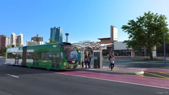
City and VIA Metropolitan Transit officials broke ground earlier this year on the Green Line, the transit agency’s planned 10.35-mile advanced rapid transit corridor designed to improve transportation access within the route from the San Antonio International Airport south to the Missions.
Construction on the eight-phased route is expected to reach completion by 2028, according to VIA.
See below for a map of the planned Green Line route.
Planned map for VIA Metropolitan Transit’s Rapid Green Line (VIA Metropolitan Transit)
Movements on both transit lines
While VIA is handling the corridor’s creation, the Transportation Department is handling walkability and connectivity leading to the transit stations, Joe Conger, a Transportation Department spokesperson, said in an email to KSAT.
The open house meetings are a continuation of early engagement steps, gathering feedback from nearby residents on what they would like to see within a 10-minute walk of the corridor, Conger said.
“We’ve taken that input and evaluated the existing conditions in each area and now are going back to the public in this series of public meetings so the public can validate our findings and ensure we’re using the right tools in the right locations,” he said.
Conger said the city was working to develop a Better Walk to Transit plan exploring possible pedestrian presence around the Green Line corridor.
The four stations above were selected based on safety, connectivity and environmental factors for analysis in the plan. The stations would create a template for future analysis in other areas near the Green Line, Conger said.
During a Transportation and Infrastructure Committee earlier this month, Manjairi Akalkotkar, VIA’s Major Capital Program Officer, described the Green Line as “serving as a spine” to other VIA routes.
Akalkotkar said the corridor would have 25 stations along the route.
As for the east-to-west Silver Line, which is currently 40% through its design phase, Conger said the Better Walk to Transit plan could aid planning for this route.
VIA expects the frequencies for both routes to be 10 minutes on weekdays and 15 minutes on the weekend.
“Stakeholder and public meetings for the Silver Line Station Area Plan will begin early next year,” he said. “These meetings will gather input not only on walkability improvements, but also on housing preferences and economic development opportunities along that corridor.”
Read more:
Copyright 2025 by KSAT – All rights reserved.