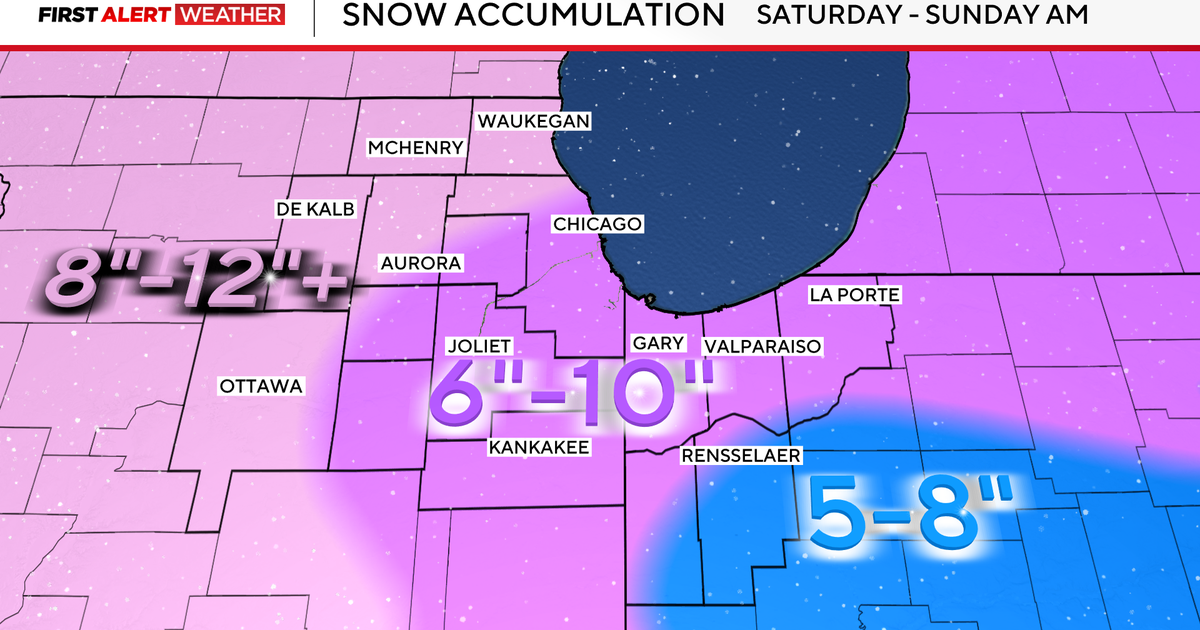
A winter storm warning is in effect in the Chicago area that could bring up to 6-12 inches of snow in some areas through Sunday.
The warning took effect overnight Saturday and continues through 6 a.m. on Sunday for all of the Chicago area and northwest Indiana.
Widespread snowfall totals of 6 to 8 inches have been recorded across the area, including 6.9 inches at O’Hare as of 6 p.m. This breaks the daily snowfall record at O’Hare and makes Saturday the fifth snowiest November day on record, at least so far. A few more inches of snow are expected overnight, so it’s likely today will go down as the snowiest November day in Chicago in 50 years.

CBS
The snow arrived late Friday night and became widespread by 7 a.m. on Saturday. The heaviest snow fell on Saturday between noon and 6 p.m., reaching 1 to 2 inches per hour.

Those who have to be out are advised to allow for extra travel time and to drive slowly, as slick travel is still a factor.
Snow totals Saturday
Some areas in the Chicago area have recorded snow totals nearing 8 inches. So far, Evanston and Oak Brook Terrace are reporting 8-inch totals, while Mount Prospect, Aurora, and McHenry have seen 7 inches of snow.


CBS News Chicago will continue to provide updates on snow totals.
Snow continues into Sunday and Monday
Between 1 to 3 inches are expected overnight through early Sunday morning. By the afternoon, a few lake-enhanced snow showers are expected. Blowing and drifting snow is expected as winds gust up to 30 mph. Winds will send wind chill values into the teens and 20s.
We are tracking two doses of lighter snow on the way next week, arriving Monday night and Wednesday.
On Monday, snow returns in the afternoon and evening, with an additional up to 2 inches possible, leading to more slick travel.
Temperatures are forecast to stay below normal (and below freezing) for the next 14 days or more, leading to persistent snowpack.
More from CBS News