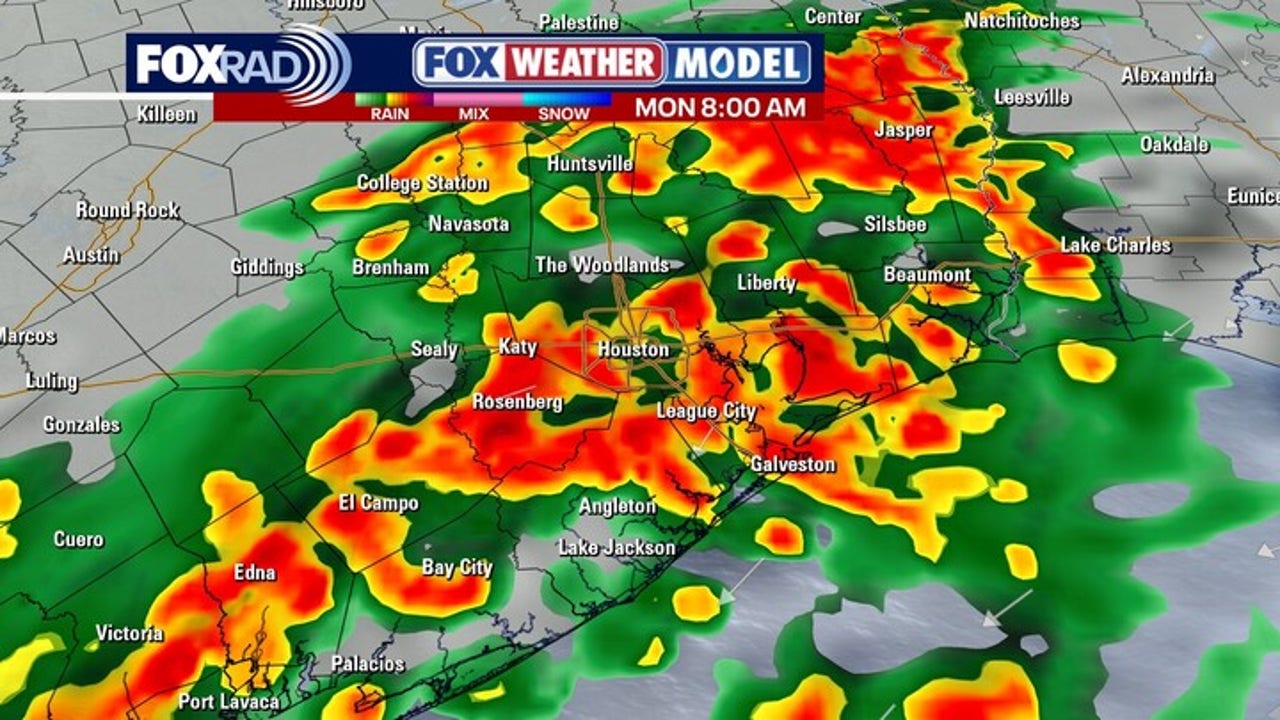
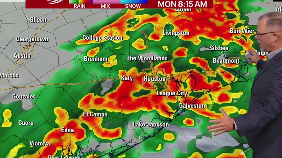
HOUSTON – Brace yourself for a winter-like start to the week with dreary, chilly rain on Monday.
Stormy weekend
We saw a stormy Saturday night in Southeast Texas.
A cold front produced a line of storms that was not severe, but flash flooding was a concern. Parts of Houston saw rainfall rates exceeding 2 inches per hour. The I-45 corridor saw nearly 4 inches in a 24-hour period.
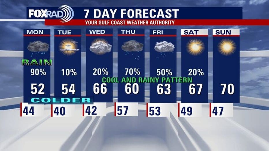
Monday looks cold & wet
Brace yourself for a winter-like start to the week with dreary, chilly rain on Monday. Make sure you allow extra time on your morning commute as you head back in after the holidays as widespread rain is expected for most of the day on Monday.
A couple of cold mornings on Tuesday and Wednesday are coming with lows in the upper 30s and low 40s.
So plan on a chilly start to December and get the coats ready!
 Flash flooding concerns
The risk of flash flooding continues into tomorrow. Inches of rainfall are expected these next few days.
Hours of rainfall are expected beginning tomorrow morning and lasting into the afternoon.
While the area is still mostly in drought and welcomes some rainfall, too much rain in a short amount of time will create flooded roads. With an already saturated ground, our coastal counties are at a level 1 out of 4 risk of flash flooding for Monday.
Be safe and stay connected to FOX26!
The Source: Your Gulf Coast Weather Authority