PHILADELPHIA – You don’t need to make that emergency run to the store for milk and bread, but Tuesday’s winter storm will bring some places the first snowflakes of winter.
When will it snow?
What we know:
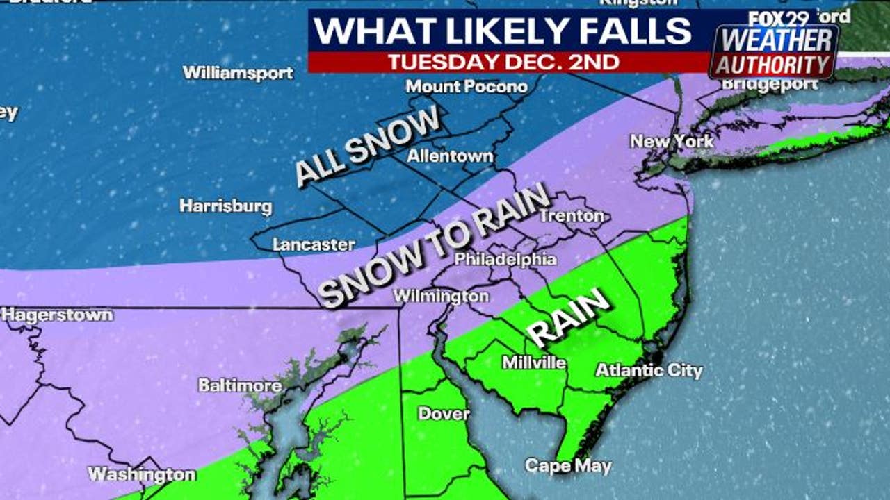
Forecasters say the incoming storm will approach Philadelphia around 5 a.m., bringing snowflakes to places mainly north and west of the city.
The rain-snow line will flirt with Philadelphia and places along the I-95 corridor through the afternoon, before rain becomes more widespread.
How much will it snow?
Local perspective:
Philadelphia and areas close to it will be mostly spared from the snow, but a wintry mix will be possible throughout the morning.
Places north and west of the city will see small accumulations, including Reading and Lancaster, where forecasters expect over 2 inches.
Areas closer to Philadelphia, like Chester and Bucks counties, could also see a dusting of snow from Tuesday’s storm.
Rain changing to snow
Forecasters expect the rain-snow line to wrap around Philadelphia and keep snow mostly away from the city.
Rain will dominate Tuesday in Philadelphia and South Jersey, with showers becoming heavy at times in the afternoon.
The rain will become more widespread as the day continues, as temperatures rise into the 40s in most places.
What’s next:
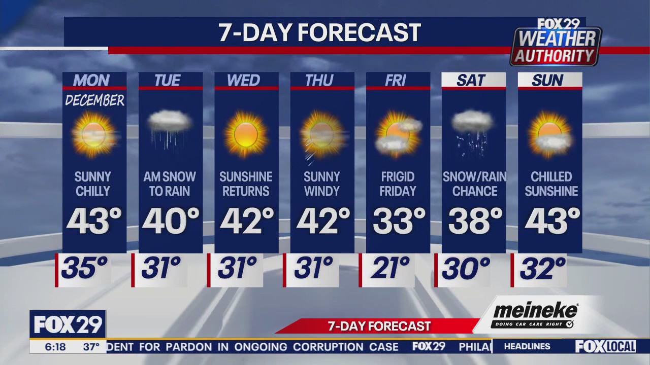
A seasonable weather pattern will follow in the wake of Tuesday’s storm, with three consecutive days of sunshine and temperatures in the 40s.
Conditions will turn more frigid on Friday with highs barely reaching above the freezing point.
Forecasters are keeping their eyes on another chance of more winter weather on Saturday.